Oxley Oval, Port Macquarie
Map
Facts and practical information
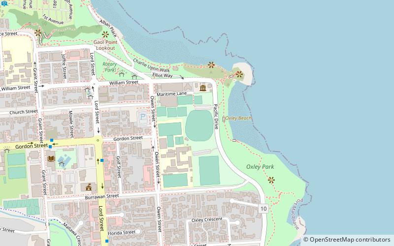
Oxley Oval is an Australian cricket ground situated in Port Macquarie, New South Wales which hosted a 1979 World Series Cricket match between the WSC West Indian XI and WSC World XI sides. The match, which began on 2 January, saw a seven-wicket West Indian victory thanks largely to four wickets by Wayne Daniel and a score of 83 by Viv Richards. ()
Coordinates: 31°25'56"S, 152°55'18"E
Address
Port Macquarie
ContactAdd
Social media
Add
Getting there by public transportation
Public transportation stops near this location
- Bus
 Bus
Bus
- Calculate routeMunster Street at Church Street 15 min walk
- Calculate routeLord Street after Hill Street 15 min walk
- Calculate routeHill Street at Rose Street 15 min walk
Day trips


Frequently Asked Questions (FAQ)
Which popular attractions are close to Oxley Oval?
Nearby attractions include Port Macquarie-Hastings Council, Port Macquarie (9 min walk), Port Macquarie First Burying Ground, Port Macquarie (14 min walk), Port Macquarie Government House Site, Port Macquarie (15 min walk), St Thomas's Anglican Church, Port Macquarie (18 min walk).
How to get to Oxley Oval by public transport?
The nearest stations to Oxley Oval:
Bus
Bus
- Munster Street at Church Street • Lines: 334K (15 min walk)
- Lord Street after Hill Street • Lines: 334K (15 min walk)