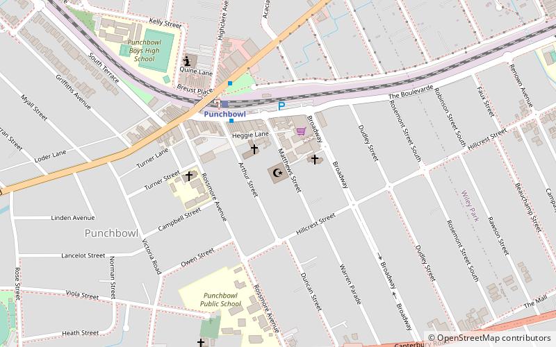
Punchbowl Mosque, Sydney
Map
Facts and practical information
Coordinates: 33°55'38"S, 151°3'27"E
Address
25-33 Matthews StreetCanterbury (Punchbowl)Sydney
ContactAdd
Social media
Add
Getting there by public transportation
Public transportation stops near this location
- Bus
- Train
 Bus
Bus
- Calculate routePunchbowl 4 min walk
- Calculate routeWiley Park 17 min walk
- Calculate routeLakemba 30 min walk
- Calculate routeMarcella Street 28 min walk
- Calculate routeStacey Street South 29 min walk
- Calculate routeStand 2, Bankstown Central Shops 36 min walk
- Calculate routeStand 3, Bankstown Central Shops 36 min walk
Maps Sydney TrainsMaps
 Sydney Light RailMaps
 Sydney Ferries
Sydney TrainsMapsSydney Light RailMapsSydney FerriesDay trips


Frequently Asked Questions (FAQ)
How to get to Punchbowl Mosque by public transport?
The nearest stations to Punchbowl Mosque:
Train
Bus
Train
- Punchbowl (4 min walk)
- Wiley Park (17 min walk)
Bus
- Marcella Street • Lines: M91 (28 min walk)
- Stacey Street South • Lines: M91 (29 min walk)