Salt Pan Creek, Sydney
Map
Facts and practical information
Address
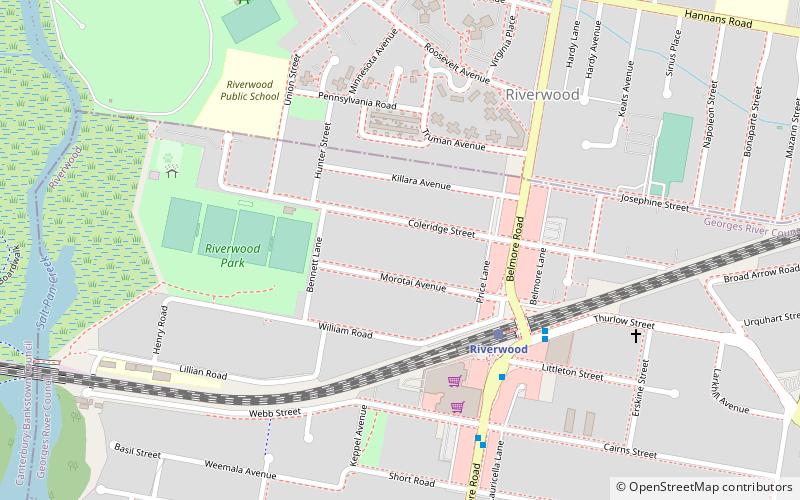
Canterbury (Riverwood)Sydney
ContactAdd
Social media
Add
Getting there by public transportation
Public transportation stops near this location
- Bus
- Train
 Bus
Bus
- Calculate routeRiverwood 5 min walk
- Calculate routePadstow 27 min walk
- Calculate routeNarwee 30 min walk
- Calculate routePeakhurst West Shops 19 min walk
- Calculate routeBelmore Road 20 min walk
- Calculate routeWaldo Crescent 23 min walk
- Calculate routeJacques Avenue 24 min walk
Maps Sydney TrainsMaps
 Sydney Light RailMaps
 Sydney Ferries
Sydney TrainsMapsSydney Light RailMapsSydney FerriesDay trips


Frequently Asked Questions (FAQ)
How to get to Salt Pan Creek by public transport?
The nearest stations to Salt Pan Creek:
Train
Bus
Train
- Riverwood (5 min walk)
- Padstow (27 min walk)
Bus
- Peakhurst West Shops • Lines: M91 (19 min walk)
- Belmore Road • Lines: M91 (20 min walk)