Trek Zone

Barbados National Stadium, Bridgetown

#25 among attractions in Bridgetown

Football, Sport venue, Sport, Arenas and stadiums
Barbados National Stadium location map
Map

Facts and practical information
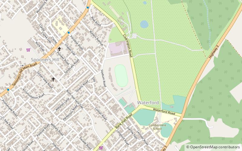
Alternative names: Opened: 1970 (54 years ago)Capacity: 15 thous.Coordinates: 13°7'13"N, 59°36'17"W
Address

Stadium RoadBridgetown Barbados

ContactAdd
Social media
Day trips

Barbados National Stadium – popular in the area (distance from the attraction)

Nearby attractions include: Kensington Oval, Chamberlain Bridge, Nidhe Israel Synagogue, Parliament Buildings.

  • kensington oval bridgetown1.6 miSW
  • chamberlain bridge bridgetown1.8 miS
  • nidhe israel synagogue bridgetown1.6 miSW
  • parliament buildings bridgetown1.7 miS
  • national heroes square bridgetown1.7 miS
  • queens park bridgetown location map
    1.5 miS
  • cathedral church of saint michael and all angels bridgetown1.6 miS
  • bussa emancipation statue bridgetown2 miSE
  • sky mall bridgetown2 miSE
  • port of bridgetown2.1 miSW
  • national library service of barbados bridgetown1.6 miSW

Where to next? Visit saint michael Saint Michael region page or discover the top tourist attractions in Barbados.