Place Jean Rey, Brussels
Map

Gallery

Facts and practical information
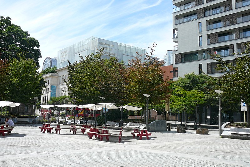
The Place Jean Rey is a square in the European Quarter of Brussels, Belgium. It was inaugurated in 2001 and is named after Jean Rey, the second President of the European Commission. ()
Coordinates: 50°50'25"N, 4°22'49"E
Day trips
Place Jean Rey – popular in the area (distance from the attraction)
Nearby attractions include: Museum of Natural Sciences, Jazz Station, House of European History, Leopold Park.
Frequently Asked Questions (FAQ)
Which popular attractions are close to Place Jean Rey?
Nearby attractions include House of European History, Brussels (3 min walk), Chapel of the Resurrection, Brussels (3 min walk), Leopold Park, Brussels (4 min walk), Europa building, Brussels (4 min walk).
How to get to Place Jean Rey by public transport?
The nearest stations to Place Jean Rey:
Bus
Train
Metro
Tram
Bus
- Parc Léopold - Leopoldspark • Lines: 21, 27, 543, 59, 64 (2 min walk)
- Froissart • Lines: 21, 27, 36, 543, 59, 60, N06 (3 min walk)
Train
- Brussels-Schuman (5 min walk)
- Brussels-Luxembourg (9 min walk)
Metro
- Schuman • Lines: 1, 5 (5 min walk)
- Maelbeek - Maalbeek • Lines: 1, 5 (8 min walk)
Tram
- Acacias - Acacia • Lines: 81 (18 min walk)
- Place Saint-Pierre - St-Pietersplein • Lines: 81 (19 min walk)

 Metro / Rail


