Salla Jipiña, Chacaltaya
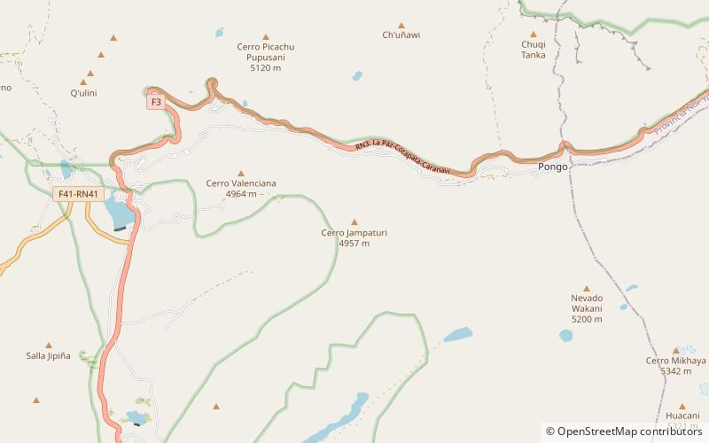
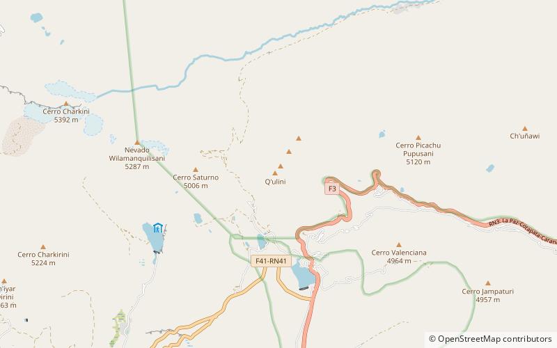
#5 among attractions in Chacaltaya

Facts and practical information
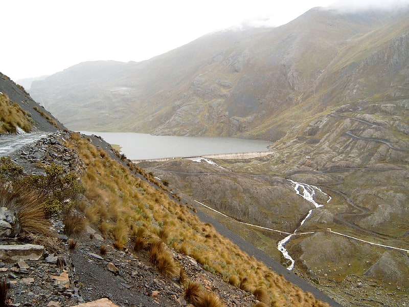
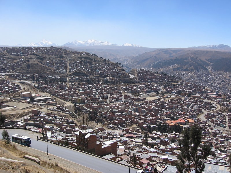
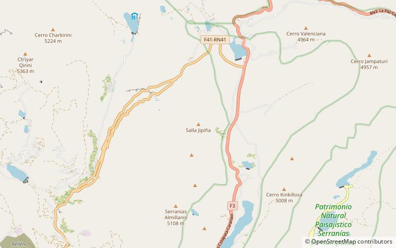
Salla Jipiña is a 4,944-metre-high mountain in the Cordillera Real in the Bolivian Andes. It lies in the La Paz Department, Murillo Province, La Paz Municipality. Salla Jipiña is situated south-east of the mountains Ch'iyar Qirini and Chacaltaya. ()
Chacaltaya Bolivia
Salla Jipiña – popular in the area (distance from the attraction)
Nearby attractions include: Inkachaka Dam, Ch'iyar Qirini, Laram Quta, Laram Quta.
2.5 miS
Nature, Natural attraction, LakeInkachaka Dam
65 min walk • Inkachaka Dam is a dam in Bolivia situated in the La Paz Department, Pedro Domingo Murillo Province, La Paz Municipality, north east of La Paz.
4.3 miW
Nature, Natural attraction, MountainCh'iyar Qirini, Chacaltaya
110 min walk • Ch'iyar Qirini is a 5,363-metre-high mountain in the Cordillera Real in the Bolivian Andes, north-east of La Paz. It lies in the La Paz Department, Murillo Province, La Paz Municipality, near the border with the El Alto Municipality.
5.1 miW
Nature, Natural attraction, LakeLaram Quta, Chacaltaya
130 min walk • Laram Quta is a lake in Bolivia located in the La Paz Department, Pedro Domingo Murillo Province, El Alto Municipality. It lies south of the mountain Chacaltaya, south-east of Milluni Lake, south-west of the Qillwani Lakes and north-west of Qillwani.
2.9 miNW
Nature, Natural attraction, LakeLaram Quta
74 min walk • Laram Quta is a lake in the Cordillera Real in the Andes of Bolivia. It is situated in the La Paz Department, Pedro Domingo Murillo Province, La Paz Municipality, La Paz Canton. It lies south-west of the lake Pata Larama. The wetlands of this area are also known as Pampa Larama.
4.2 miE
Nature, Natural attraction, MountainJamp'aturi
108 min walk • Jamp'aturi is a 4,871-metre-high mountain in the Cordillera Real in the Andes of Bolivia. It is located in the La Paz Department, Pedro Domingo Murillo Province, La Paz Municipality, north-east of the city of La Paz.
5.4 miW
Nature, Natural attraction, LakePhaq'u Quta, Chacaltaya
139 min walk • Phaq'u Quta is a lake in Bolivia located in the La Paz Department, Pedro Domingo Murillo Province, El Alto Municipality. It is situated at a height of about 4,667 metres south of the mountain Chacaltaya, south-east of Milluni Lake and south-west of Qillwani.
3.4 miN
Nature, Natural attraction, MountainQ'ulini, Cotapata National Park and Integrated Management Natural Area
87 min walk • Q'ulini is a 4,968-metre-high mountain in the Cordillera Real in the Bolivian Andes. It is located in the La Paz Department, Murillo Province, La Paz Municipality. Q'ulini is situated southeast of the mountain Qala Uyu. It lies northeast of the lake Laram Quta at the wetlands known as Pampa Larama.
6.1 miNE
Nature, Natural attraction, MountainCh'uñawi, Cotapata National Park and Integrated Management Natural Area
156 min walk • Ch'uñawi is a 4,846-metre-high mountain in the Cordillera Real in the Andes of Bolivia It lies in the La Paz Department, Murillo Province, La Paz Municipality, northeast of the city of La Paz. Ch'uñawi is situated northwest of Mik'aya and Wak'ani and northeast of Jamp'aturi.
7.3 miNE
Nature, Natural attraction, MountainChuru Pata, Cotapata National Park and Integrated Management Natural Area
187 min walk • Churu Pata is a mountain in the Andes of Bolivia which reaches a height of approximately 4,460 m. It is located in the La Paz Department, Murillo Province, La Paz Municipality. Churu Pata lies northwest of Chuqi Tanka and northeast of Ch'uñawi.
7.2 miNE
Nature, Natural attraction, MountainPukara, Cotapata National Park and Integrated Management Natural Area
185 min walk • Pukara is a mountain in the Andes of Bolivia which reaches a height of approximately 4,320 m. It is located in the La Paz Department, Murillo Province, La Paz Municipality. Pukara lies north of Ch'uñawi.