


Serra da Mantiqueira Environmental Protection Area Travel Guide
Facts and practical information
Nestled in the beautiful Minas Gerais region of Brazil, the Serra da Mantiqueira Environmental Protection Area is a nature lover's dream come true. This vast expanse of land, spanning over 2,800 square kilometers, is a haven for biodiversity and natural wonders. From towering mountains to crystal-clear lakes, this protected area offers a wide range of experiences for visitors seeking to connect with nature.
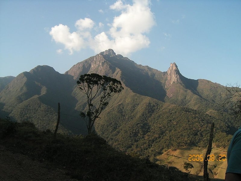
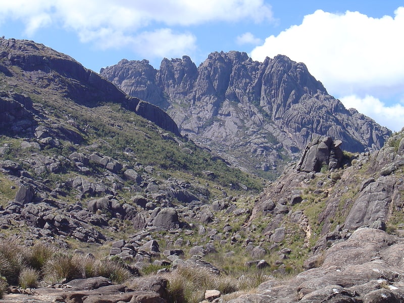
One of the highlights of the Serra da Mantiqueira Environmental Protection Area is its stunning mountain range. With peaks reaching over 2,700 meters in altitude, the views from the top are simply breathtaking. Hiking enthusiasts will find themselves in paradise as they traverse the numerous trails that crisscross the area. As you climb higher and higher, you'll be rewarded with panoramic vistas of lush green valleys, cascading waterfalls, and dense forests that stretch as far as the eye can see.
For those seeking a more tranquil experience, the area is also home to several picturesque lakes. These serene bodies of water provide the perfect setting for a peaceful day of relaxation. Whether you choose to swim in the cool waters, have a picnic by the shore, or simply sit back and soak in the surrounding natural beauty, you'll find solace in the tranquility of these hidden gems.
Aside from its natural wonders, the Serra da Mantiqueira Environmental Protection Area is also rich in cultural heritage. The region is dotted with charming towns and villages, each with its own unique charm. From the colorful colonial architecture of São Lourenço to the artistic vibe of Monte Verde, there's something for everyone to explore and discover.
To truly immerse yourself in the local culture, don't miss the opportunity to taste the traditional cuisine of the Minas Gerais region. Known for its hearty and flavorful dishes, this culinary experience will leave your taste buds wanting more. From feijoada, a delicious black bean stew, to pão de queijo, a mouthwatering cheese bread, your gastronomic journey will be a true delight.
Minas Gerais
Serra da Mantiqueira Environmental Protection Area Attractions - What to See and Explore
Serra da Mantiqueira Environmental Protection Area offers many attractions and places to visit. Here are the most important ones: Brazilian Highlands, Pedra do Baú, Pico dos Marins, Pico dos Três Estados. Below you will find a complete list of places worth visiting.


Serra da Mantiqueira Environmental Protection Area – popular in the area (distance from the center)
In the vicinity of Serra da Mantiqueira Environmental Protection Area, it's worth seeing attractions such as: Basilica of Our Lady of Aparecida (Aparecida), Old Cathedral of St. Anthony (Guaratinguetá), Pharmácia Popular (Bananal).


Best Time To Visit Serra da Mantiqueira Environmental Protection Area
Learn when is the best time to travel to Serra da Mantiqueira Environmental Protection Area weather-wise and what to expect in each season.