Avenida Dois Rios, Recife
Facts and practical information
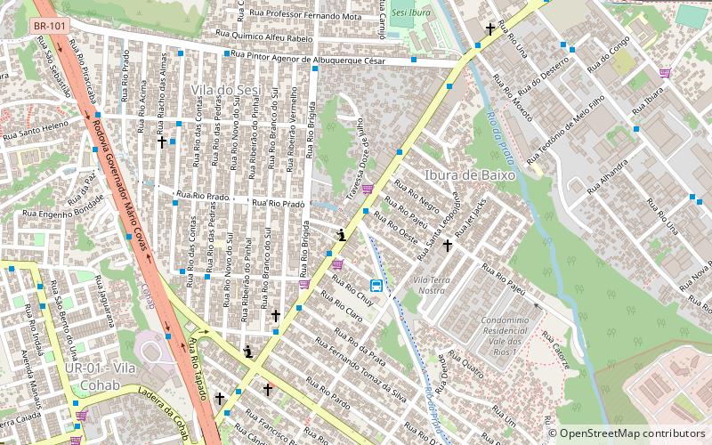
Avenida Dois Rios (address: Av. Dois Rios, 783 - Ibura) is a place located in Recife (Pernambuco state) and belongs to the category of bridge.
It is situated at an altitude of 39 feet, and its geographical coordinates are 8°6'51"S latitude and 34°56'22"W longitude.
Planning a visit to this place, one can easily and conveniently get there by public transportation. Avenida Dois Rios is a short distance from the following public transport stations: Terminal de Lagoa Encantada (bus, 22 min walk).
Among other places and attractions worth visiting in the area are: Academia da Cidade UR-05 (park, 36 min walk), Ginásio de Esportes Geraldo Magalhães (arenas and stadiums, 48 min walk), Itapuama Beach (beach, 55 min walk).
Av. Dois Rios, 783 - IburaRPA6 (Ibura)Recife
- Bus
 Bus
Bus
- Calculate routeTerminal de Lagoa Encantada 22 min walk
- Calculate routeTerminal de Ônibus Jordão Baixo 29 min walk
- Calculate routeTerminal de Ônibus UR-02 Ibura 29 min walk
- Calculate routeTerminal UR-02 Ibura 29 min walk
Frequently Asked Questions (FAQ)
How to get to Avenida Dois Rios by public transport?
Bus
- Terminal de Lagoa Encantada (22 min walk)
- Terminal de Ônibus Jordão Baixo (29 min walk)