Rua Ribeiro de Brito, Recife
Facts and practical information
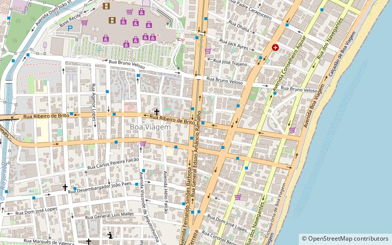
Rua Ribeiro de Brito (address: Rua: Ribeiro de Brito 554 sala 06 Empresarial Monteiro de Melo) is a place located in Recife (Pernambuco state) and belongs to the category of bridge.
It is situated at an altitude of 26 feet, and its geographical coordinates are 8°7'24"S latitude and 34°54'5"W longitude.
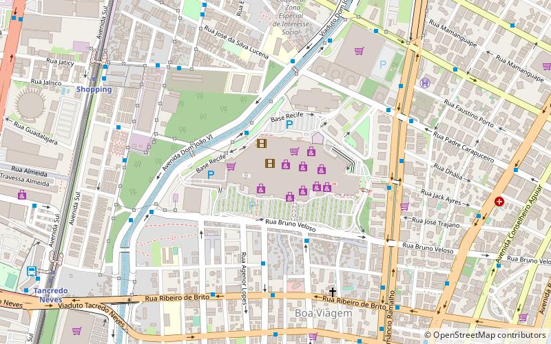
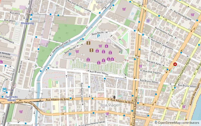
Planning a visit to this place, one can easily and conveniently get there by public transportation. Rua Ribeiro de Brito is a short distance from the following public transport stations: Praça de Boa Viagem (bus, 15 min walk), Tancredo Neves (metro, 19 min walk).
Among other places and attractions worth visiting in the area are: Rua Ernesto de Paula Santos (bridge, 2 min walk), Bistro & Boteco (shopping, 8 min walk), Shopping Recife (shopping, 10 min walk).
Rua: Ribeiro de Brito 554 sala 06 Empresarial Monteiro de MeloRPA6 (Boa Viagem)Recife
- Metro
- Bus
 Metro
Metro
- Calculate routePraça de Boa Viagem 15 min walk
- Calculate route023 - TI Aeroporto 20 min walk
- Calculate route023 - Shopping Recife 20 min walk
- Calculate routeTerminal Integrado Tancredo Neves 20 min walk
- Calculate routeTancredo Neves 19 min walk
- Calculate routeShopping 21 min walk
- Calculate routeAntônio Falcão 28 min walk
- Calculate routeAeroporto 30 min walk
Rua Ribeiro de Brito – popular in the area (distance from the attraction)
Nearby attractions include: Shopping Recife, Bistro & Boteco, Itapuama Beach, Rua Ernesto de Paula Santos.
Frequently Asked Questions (FAQ)
Which popular attractions are close to Rua Ribeiro de Brito?
How to get to Rua Ribeiro de Brito by public transport?
Bus
- Praça de Boa Viagem • Lines: 023 (15 min walk)
- 023 - TI Aeroporto • Lines: 023 (20 min walk)
Metro
- Tancredo Neves • Lines: 3 (19 min walk)
- Shopping • Lines: 3 (21 min walk)