Tatuapé, São Paulo
Map

Map

Facts and practical information
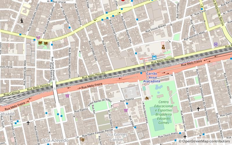
Tatuapé is a district in the subprefecture of Mooca, in São Paulo, Brazil. It is divided by a railway and the eight lane Radial Leste highway cutting the district into two, northern and southern, parts. ()
Day trips
Tatuapé – popular in the area (distance from the attraction)
Nearby attractions include: Estádio Alfredo Schürig, Shopping Metrô Tatuapé, Paróquia São Paulo Apóstolo, Basílica Nossa Senhora da Penha.
Frequently Asked Questions (FAQ)
How to get to Tatuapé by public transport?
The nearest stations to Tatuapé:
Bus
Metro
Trolleybus
Bus
- Rua Melo Freire • Lines: 3414-10, 4310-10, 4310-21, 4312-10 (4 min walk)
- Rua Doutor Ângelo Vita, 303 • Lines: 172X-10 (4 min walk)
Metro
- Carrão – Assaí Atacadista • Lines: 3 (5 min walk)
- Tatuapé • Lines: 3 (17 min walk)
Trolleybus
- Parada 1/3 - Hosp. Municipal Tatuapé • Lines: 2290-10 (7 min walk)
- Parada 1/3 - Hosp. Munic. Tatuapé • Lines: 2290-10, 2290-21 (8 min walk)

 Metro / Suburban rail


