Victoria Park, Edmonton
Map
Facts and practical information
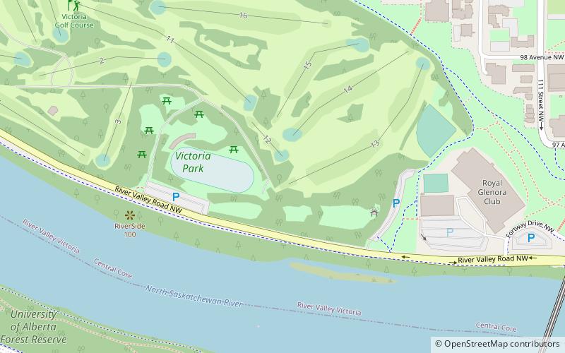
Victoria Park is a municipal park in Edmonton, Alberta, that is part of the North Saskatchewan River valley parks system. The park features paved cycling and walking paths and several other amenities. Like the other parks in the valley parks system, the park is connected to others via multi-use trails. The park was named in honour of Queen Victoria. ()
Elevation: 2064 ft a.s.l.Coordinates: 53°32'1"N, 113°31'12"W
Address
12130 River Valley Rd NWNorth Central Edmonton (River Valley Victoria)Edmonton T5K 1V5
Contact
Social media
Add
Getting there by public transportation
Public transportation stops near this location
- Bus
- Light rail
 Bus
Bus
- Calculate routeGovernment Centre Station 12 min walk
- Calculate routeUniversity 16 min walk
- Calculate routeCorona 21 min walk
- Calculate route114 Street & Jasper Ave 14 min walk
- Calculate route117 Street & Jasper Ave 14 min walk
- Calculate route113 Street & Jasper Ave 14 min walk
- Calculate route119 Street & Jasper Ave 15 min walk
Day trips


Frequently Asked Questions (FAQ)
Which popular attractions are close to Victoria Park?
Nearby attractions include Dudley B. Menzies Bridge, Edmonton (10 min walk), High Level Bridge, Edmonton (12 min walk), St. Joseph's Basilica, Edmonton (13 min walk), Rutherford House, Edmonton (14 min walk).
How to get to Victoria Park by public transport?
The nearest stations to Victoria Park:
Light rail
Bus
Light rail
- Government Centre Station • Lines: 501, 502 (12 min walk)
- University • Lines: 501, 502 (16 min walk)
Bus
- 114 Street & Jasper Ave • Lines: 2, 2-Owl, 5 (14 min walk)
- 117 Street & Jasper Ave • Lines: 2, 2-Owl, 5 (14 min walk)