Angell Woods, Island of Montreal
Map
Facts and practical information
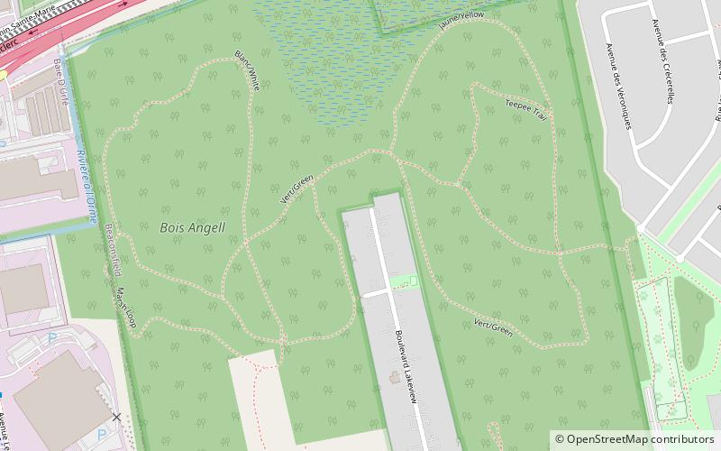
Angell Woods is an old-growth forest in Beaconsfield, Quebec, Canada. It is bordered by Quebec Autoroute 20 to the south, Quebec Autoroute 40 to the north, an industrial park in Baie-D'Urfé to the west, and a residential subdivision to the east. ()
Coordinates: 45°25'54"N, 73°53'39"W
Address
West Island (Beaconsfield)Island of Montreal
ContactAdd
Social media
Add
Getting there by public transportation
Public transportation stops near this location
- Bus
- Train
 Bus
Bus
- Calculate routeSainte-Marie / de l'Anse-à-l'Orme 10 min walk
- Calculate routeSainte-Marie / Meaney 11 min walk
- Calculate routede l'Anse-à-l'Orme / Sainte-Marie 11 min walk
- Calculate routeLee / Cruickshank 12 min walk
- Calculate routeBeaurepaire 12 min walk
- Calculate routeBaie-d'Urfé 34 min walk
Day trips
Angell Woods – popular in the area (distance from the attraction)
Nearby attractions include: L'Anse-à-l'Orme Nature Park, Sainte-Anne-de-Bellevue Canal, Saint-Joachim de Pointe-Claire Church, National Field of Honour.


Frequently Asked Questions (FAQ)
How to get to Angell Woods by public transport?
The nearest stations to Angell Woods:
Bus
Train
Bus
- Sainte-Marie / de l'Anse-à-l'Orme • Lines: 217-O, 219-O (10 min walk)
- Sainte-Marie / Meaney • Lines: 217-E, 217-O, 219-O (11 min walk)
Train
- Beaurepaire (12 min walk)
- Baie-d'Urfé (34 min walk)