Shaarey Zedek Synagogue, Winnipeg
Map
Facts and practical information
Shaarey Zedek Synagogue is the oldest synagogue in Winnipeg, Manitoba, Canada. Formed in 1880, the congregation's first building was constructed by Philip Brown and several others in 1890. Architect Charles Henry Wheeler designed the original Synagogue on King Street. ()
Completed: 1950 (76 years ago)Capacity: 1500Coordinates: 49°52'38"N, 97°9'43"W
Getting there by public transportation
Public transportation stops near this location
- Bus
 Bus
Bus
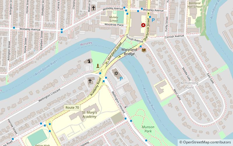
- Calculate routeWestbound Wellington at Academy 1 min walk
- Calculate routeEastbound Academy at Wellington Crescent 2 min walk
- Calculate routeNorthbound Sherbrook at West Gate 4 min walk
Day trips


Frequently Asked Questions (FAQ)
Which popular attractions are close to Shaarey Zedek Synagogue?
Nearby attractions include Maryland Bridge, Winnipeg (2 min walk), Cornish Library, Winnipeg (3 min walk), Armstrong's Point, Winnipeg (7 min walk), The Stoneware Gallery, Winnipeg (16 min walk).
How to get to Shaarey Zedek Synagogue by public transport?
The nearest stations to Shaarey Zedek Synagogue:
Bus
Bus
- Westbound Wellington at Academy • Lines: 635 (1 min walk)
- Eastbound Academy at Wellington Crescent • Lines: 20, 29 (2 min walk)