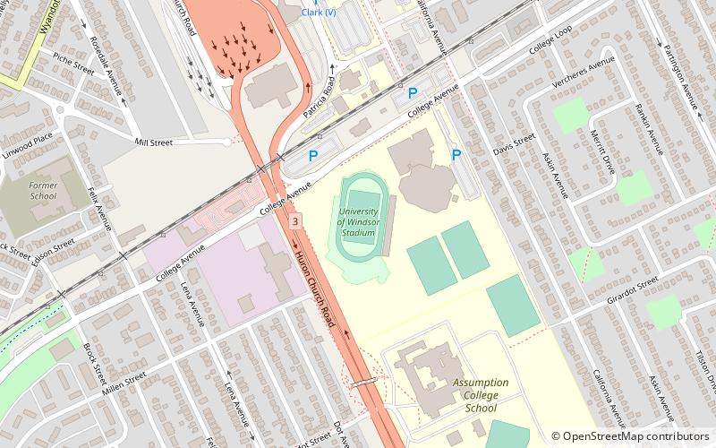
University of Windsor Stadium, Windsor
Map
Facts and practical information
University of Windsor Stadium, also known as Alumni Field, South Campus Stadium and St. Denis Centre Stadium, is a 2,000-seat stadium located in Windsor, Ontario, Canada. The stadium is mainly used for soccer and Canadian football. It is home to the Windsor Lancers, the athletic teams of the University of Windsor. ()
Opened: 2005 (21 years ago)Capacity: 2000Coordinates: 42°17'53"N, 83°3'47"W
Address
West Side (Windsor University District)Windsor
ContactAdd
Social media
Add
Getting there by public transportation
Public transportation stops near this location
- Bus
 Bus
Bus
- Calculate routeWest Windsor Bus Terminal 21 min walk
Day trips


Frequently Asked Questions (FAQ)
Which popular attractions are close to University of Windsor Stadium?
Nearby attractions include University of Windsor, Windsor (13 min walk), Assumption University, Windsor (17 min walk), Old Sandwich Town, Windsor (17 min walk), Mackenzie Hall, Windsor (18 min walk).
How to get to University of Windsor Stadium by public transport?
The nearest stations to University of Windsor Stadium:
Bus
Bus
- West Windsor Bus Terminal (21 min walk)