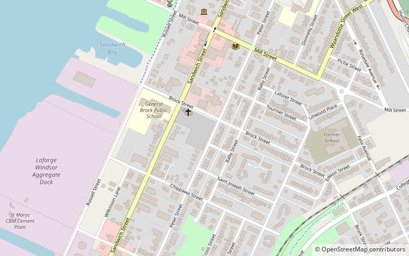
Old Sandwich Town, Windsor
Map
Facts and practical information
Old Sandwich Town is located along the Canada–US border of the Detroit River, and was established in 1797. It is considered one of the oldest, most historically significant settlements in Ontario and has been the site of several historically significant events in Ontario's history. Many historic buildings remain in Old Sandwich Town and the area hosts an annual festival to celebrate its heritage. The area is now a neighbourhood of the city of Windsor. ()
Coordinates: 42°17'56"N, 83°4'34"W
Address
West Side (Sandwich)Windsor
ContactAdd
Social media
Add
Getting there by public transportation
Public transportation stops near this location
- Bus
 Bus
Bus
- Calculate routeWest Windsor Bus Terminal 27 min walk
Day trips


Frequently Asked Questions (FAQ)
Which popular attractions are close to Old Sandwich Town?
Nearby attractions include Mackenzie Hall, Windsor (2 min walk), Duff Baby House, Windsor (6 min walk), Dominion House, Windsor (8 min walk), Sandwich First Baptist Church, Windsor (14 min walk).
How to get to Old Sandwich Town by public transport?
The nearest stations to Old Sandwich Town:
Bus
Bus
- West Windsor Bus Terminal (27 min walk)