Trek Zone

Bulyea Heights, Edmonton
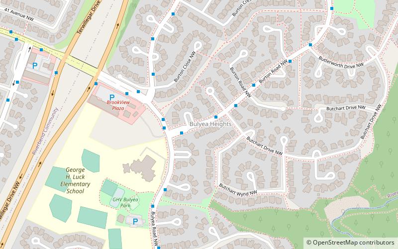
#394 among attractions in Edmonton

Neighbourhood
Bulyea Heights location map
Map

Facts and practical information

Area: 0.58 mi²Coordinates: 53°28'30"N, 113°34'12"W
Address

Southwest Edmonton (Bulyea Heights)Edmonton Canada

ContactAdd
Social media
Add
Day trips

Bulyea Heights – popular in the area (distance from the attraction)

Nearby attractions include: Edmonton Alberta Temple, Terwillegar Park Footbridge, Brookside, Snow Valley Ski Club.

  • edmonton alberta temple1 miN
  • terwillegar park footbridge edmonton1.2 miW
  • brookside edmonton1.1 miN
  • snow valley ski club edmonton0.9 miNE
  • edmonton whitemud location map
    1.2 miE
  • ramsay heights edmonton0.7 miNW
  • carter crest edmonton location map
    0.8 miSW
  • leger edmonton1.2 miS
  • henderson estates edmonton1.3 miSW
  • falconer heights edmonton1 miSW
  • blue quill estates edmonton location map
    1.7 miSE

Frequently Asked Questions (FAQ)

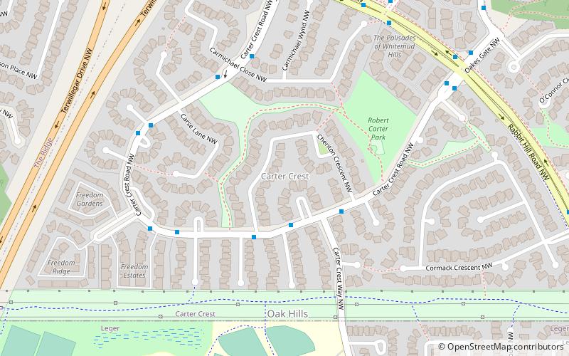
Which popular attractions are close to Bulyea Heights?

Nearby attractions include Ramsay Heights, Edmonton (18 min walk), Rhatigan Ridge, Edmonton (20 min walk), Ogilvie Ridge, Edmonton (21 min walk), Carter Crest, Edmonton (22 min walk).

Where to next? Visit alberta Alberta region page or discover the top tourist attractions in Canada.