Boulevard Fournier, Gatineau
Map
Facts and practical information
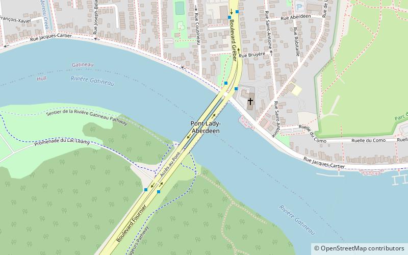
Boulevard Fournier is a main route in the city of Gatineau, Quebec that connects the Gatineau and Hull sectors. It starts as the extension of Boulevard Greber in the old city of Gatineau and ends at the entrance of the downtown core where it becomes Boulevard Maisonneuve which connects the Portage Bridge towards Ottawa. It was once part of Route 148 until the Quebec Ministry of Transportation rerouted the provincial highway onto Autoroute 50 and Autoroute 5 as a concurrency. ()
Coordinates: 45°27'24"N, 75°42'4"W
Address
Pointe-GatineauGatineau
ContactAdd
Social media
Add
Getting there by public transportation
Public transportation stops near this location
- Bus
 Bus
Bus
- Calculate routede la Gappe/Carmen 25 min walk
- Calculate routeSussex / Alexander 27 min walk
- Calculate routeJohn / Sussex 27 min walk
Day trips


Frequently Asked Questions (FAQ)
How to get to Boulevard Fournier by public transport?
The nearest stations to Boulevard Fournier:
Bus
Bus
- de la Gappe/Carmen • Lines: 15 (25 min walk)
- Sussex / Alexander • Lines: 9 (27 min walk)