Gordie Howe Bridge, Saskatoon

Facts and practical information
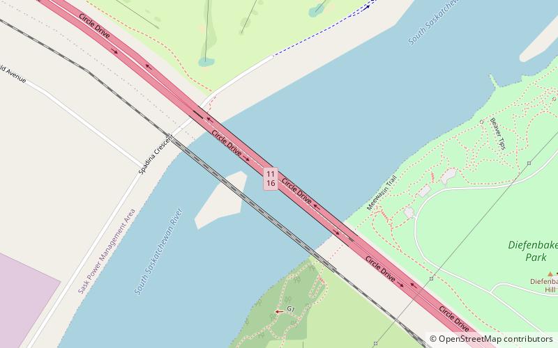
Spanning the South Saskatchewan River, the Gordie Howe Bridge stands as an iconic landmark in the city of Saskatoon, Canada. Named after the legendary hockey player Gordie Howe, who was born in the nearby Floral, Saskatchewan, this bridge serves as a vital link within the city's transportation network.
Constructed to facilitate the flow of traffic and enhance connectivity, the Gordie Howe Bridge is a testament to modern engineering and design. It supports the bustling movement of residents and visitors alike, providing a crucial artery for commerce and daily transit across the river.
With its robust structure, the bridge not only accommodates vehicular traffic but also ensures safe passage for pedestrians and cyclists, with dedicated lanes that promote sustainable modes of transportation. The bridge's strategic location offers convenience and accessibility, connecting various neighborhoods and fostering the city's urban cohesion.
The Gordie Howe Bridge is not just a functional piece of infrastructure; it also offers picturesque views of the river and the city skyline, making it a popular spot for photography and sightseeing. Its significance is further emphasized by its namesake, honoring a sports hero who has left an indelible mark on the community and the nation's hockey heritage.
Open year-round, the bridge stands resilient against the Canadian seasons, from the crisp warmth of summer to the icy grip of winter. It remains a symbol of strength and continuity in Saskatoon, proudly bearing the name of one of the country's most beloved athletes.
Confederation (Gordie Howe Management Area)Saskatoon
- Bus
 Bus
Bus
- Calculate routeRuth Street & Saint Henry Avenue 16 min walk
- Calculate routeHillard Street & Herman Avenue 22 min walk


Frequently Asked Questions (FAQ)
Which popular attractions are close to Gordie Howe Bridge?
How to get to Gordie Howe Bridge by public transport?
Bus
- Ruth Street & Saint Henry Avenue • Lines: 1 (16 min walk)
- Hillard Street & Herman Avenue • Lines: 1 (22 min walk)