Beaubien, Montreal
Map
Facts and practical information
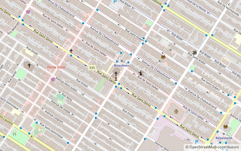
Beaubien Street is a major east-west street located in Montreal, Quebec, Canada. The street links Autoroute 25 in the east and Durocher Avenue in the west. ()
Length: 5.9 miCoordinates: 45°32'4"N, 73°36'17"W
Getting there by public transportation
Public transportation stops near this location
- Metro
- Bus
- Train
 Metro
Metro
- Calculate routeStation Beaubien 1 min walk
- Calculate routeBeaubien / Saint-Denis 1 min walk
- Calculate routeSaint-Denis / Beaubien 2 min walk
- Calculate routeBeaubien / Saint-Hubert 4 min walk
- Calculate routeBeaubien 2 min walk
- Calculate routeRosemont 11 min walk
- Calculate routeJean-Talon 14 min walk
- Calculate routeDe Castelnau 19 min walk
- Calculate routeParc 26 min walk
Maps Metro
Metro
MetroDay trips


Frequently Asked Questions (FAQ)
Which popular attractions are close to Beaubien?
Nearby attractions include Saint-Édouard, Montreal (1 min walk), Church of the Madonna della Difesa, Montreal (5 min walk), La Petite-Patrie, Montreal (8 min walk), Rosemont–La Petite-Patrie, Montreal (9 min walk).
How to get to Beaubien by public transport?
The nearest stations to Beaubien:
Bus
Metro
Train
Bus
- Station Beaubien • Lines: 160-E, 160-O, 18-E, 18-O, 30-S, 31-N (1 min walk)
- Beaubien / Saint-Denis • Lines: 160-E, 160-O, 18-E, 18-O (1 min walk)
Metro
- Beaubien • Lines: 2 (2 min walk)
- Rosemont • Lines: 2 (11 min walk)
Train
- Parc (26 min walk)