Bow Glacier Falls, Banff National Park
#12 among attractions in Banff National Park

Facts and practical information
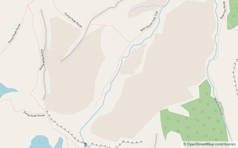
Bow Glacier Falls is located near Banff, AB. The falls originates from melt water from the Bow Glacier and flows into Bow Lake. ()
Banff National Park plan & book
Unleash the traveler in you — discover the cheapest flight deals, find the perfect hotel or hostel nearby, and search for the best car rental prices. Travel at your own pace to discover new places and enjoy your journey.
Bow Glacier Falls – popular in the area (distance from the attraction)
Nearby attractions include: Bow Lake, Mount Jimmy Simpson, Portal Peak, Bow Hut.
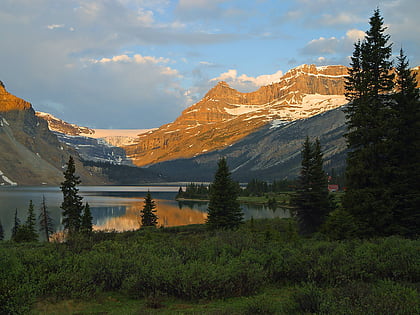
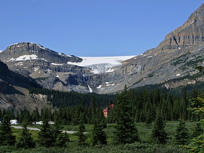
 Glacial lake with a historic lodge
Bow Lake, Banff National Park
48 min walk • Bow Lake is a small lake in western Alberta, Canada. It is located on the Bow River, in the Canadian Rockies, at an altitude of 1920 m.
 Mountain
Mount Jimmy Simpson
54 min walk • Mount Jimmy Simpson is a 2,966-metre summit located 3 kilometres northwest of Bow Lake in Banff National Park, in the Canadian Rockies of Alberta, Canada. Its nearest higher peak is Mount Thompson, 3.0 km to the southwest.
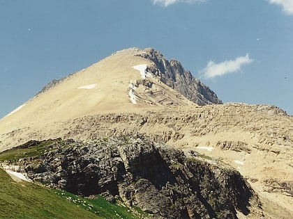
 Mountain
Portal Peak
20 min walk • Portal Peak is a 2,926-metre mountain summit located four kilometers west of Bow Lake in Banff National Park, in the Canadian Rockies of Alberta, Canada. Its nearest higher peak is Mount Thompson, 1.0 km to the northwest. Portal Peak is situated east of the Wapta Icefield, and is a member of the Waputik Mountains.
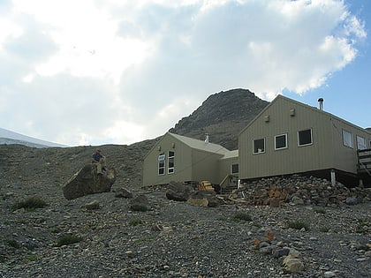 Hiking, Alpine hut
Bow Hut, Banff National Park
39 min walk • The Bow Hut is an alpine hut located at an elevation of 2,350 metres on the eastern edge of the Wapta Icefield in Banff National Park.
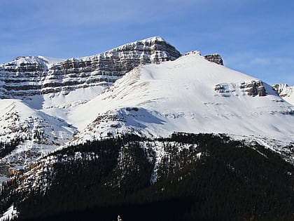
 Nature, Natural attraction, Mountain
Cirque Peak, Banff National Park
115 min walk • Cirque Peak is a 2,993-metre peak located directly west of Dolomite Pass in the Bow River valley of Banff National Park, in the Canadian Rockies of Alberta, Canada. The mountain forms a cirque, hence the name.
 Mountain
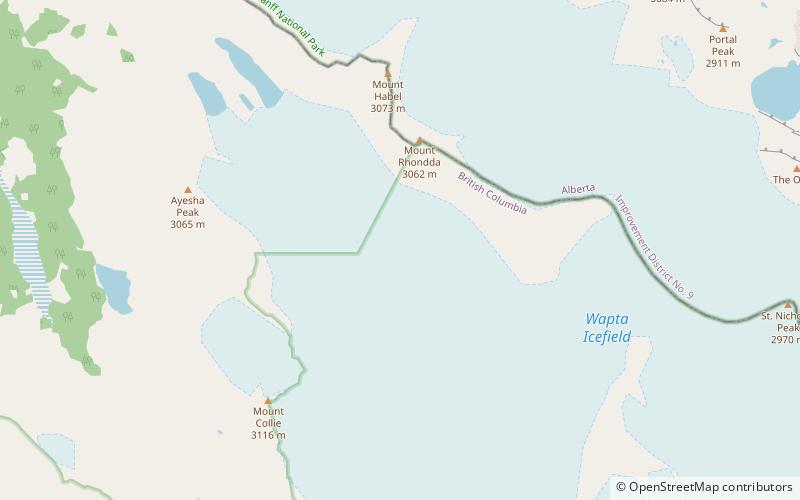
Mount Habel
83 min walk • Mount Habel is a 3,087-metre mountain summit located on the Continental Divide along the border of Alberta and British Columbia in the Waputik Mountains, part of the Canadian Rockies. It was named in 1986 after Jean Habel.
 Nature, Natural attraction, Mountain
Mount Olive, Banff National Park
78 min walk • Mount Olive is located on the Continental Divide, on the Alberta-British Columbia border, in both Banff National Park and Yoho National Park. It lies on the eastern edge of the Wapta Icefield, and is part of the Waputik Mountains. It was named in 1898 by H.B. Dixon after his wife Dixon, Olive.
 Landmark glacier seen from highway below
Crowfoot Glacier, Banff National Park
77 min walk • Crowfoot Glacier is located in Banff National Park, Alberta, Canada, 32 km northwest of Lake Louise, and can be viewed from the Icefields Parkway. The glacier is situated on the northeastern flank of Crowfoot Mountain.
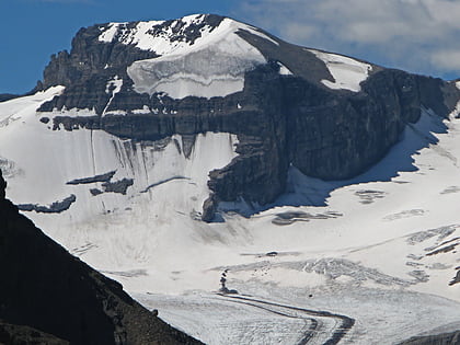
 Nature, Natural attraction, Natural feature
Peyto Glacier, Banff National Park
68 min walk • The Peyto Glacier is situated in the Canadian Rockies in Banff National Park, Alberta, Canada, approximately 90 km northwest of the town of Banff, and can be accessed from the Icefields Parkway.
 Nature, Natural attraction, Natural feature
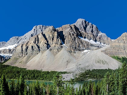
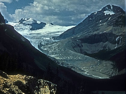
Bow Glacier, Banff National Park
23 min walk • Bow Glacier is located in Banff National Park, Alberta, Canada, approximately 37 km northwest of Lake Louise. It can be viewed from the Icefields Parkway.
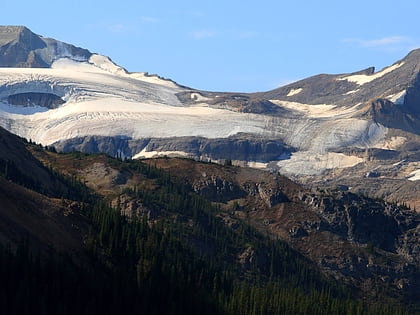
 Winter sport, Ski piste
Wapta Glacier
90 min walk • The Wapta ice fields are a series of glaciers popular with climbers on the border of Alberta and British Columbia in Yoho National Park in the Canadian Rockies. The Burgess shale animal Waptia takes its name from these features. Their meltwater feeds the nearby Wapta falls.


