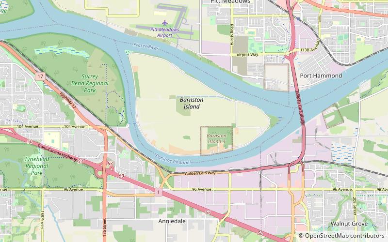
Barnston Island, Surrey
Map
Facts and practical information
Barnston Island is an unincorporated island located in the Greater Vancouver metropolitan area of British Columbia, Canada. Most of the island is part of the Greater Vancouver Electoral Area A; the remainder is Barnston Island Indian Reserve No. 3, which is outside Electoral Area A limits and is under the governance of the Katzie First Nation, headquartered across the river at their main reserve in Pitt Meadows. Although the island is unincorporated and not officially part of any municipality, mailing addresses on the island use Surrey as the city name. ()
Address
Surrey
ContactAdd
Social media
Add
Getting there by public transportation
Public transportation stops near this location
- Bus
- Ferry
 Bus
Bus
- Calculate routeBarnston Island 24 min walk
- Calculate routePort Kells 27 min walk
- Calculate route96 Ave at 188 St 28 min walk
Day trips


Frequently Asked Questions (FAQ)
How to get to Barnston Island by public transport?
The nearest stations to Barnston Island:
Ferry
Bus
Ferry
- Barnston Island • Lines: Barnston Island Ferry (24 min walk)
- Port Kells • Lines: Barnston Island Ferry (27 min walk)
Bus
- 96 Ave at 188 St • Lines: 388, 501 (28 min walk)