South Slope, Burnaby
Map
Facts and practical information
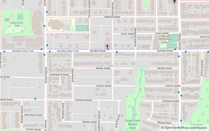
South Slope, sometimes referred to as Southern Burnaby, is a mainly single-family neighborhood in Burnaby in British Columbia, Canada, just southeast of Metrotown. It borders Suncrest, an all single-family home neighbourhood to the west, and goes as far east as Edmonds. Although the northern boundary of South Slope is Rumble Street, many residents north of the street consider themselves living in South Slope, including South Slope Elementary, and Burnaby South Secondary School. The neighbourhood gets its name from the steep slope it is located on. The neighbourhood is one of the oldest parts of the city, which can be seen be seen in Nelson Elementary, which is over a hundred years old, and dozens of Heritage Homes. ()
Coordinates: 49°12'51"N, 123°0'0"W
Address
Sussex-NelsonBurnaby
ContactAdd
Social media
Add
Getting there by public transportation
Public transportation stops near this location
- Metro
- Bus
- Trolleybus
 Metro
Metro
- Calculate routeRumble St at Gray Ave 2 min walk
- Calculate routeSussex Avenue at Rumble Street 6 min walk
- Calculate routeRoyal Oak 18 min walk
- Calculate routeMetrotown 22 min walk
- Calculate routePatterson 32 min walk
- Calculate routeMetrotown Station Bay 2 22 min walk
- Calculate routeKingsway at Willingdon Avenue 30 min walk
Day trips


Frequently Asked Questions (FAQ)
Which popular attractions are close to South Slope?
Nearby attractions include Michael J Fox Theatre, Burnaby (18 min walk), Metrotown, Burnaby (21 min walk).
How to get to South Slope by public transport?
The nearest stations to South Slope:
Bus
Metro
Trolleybus
Bus
- Rumble St at Gray Ave • Lines: 147 (2 min walk)
- Sussex Avenue at Rumble Street • Lines: 116 (6 min walk)
Metro
- Royal Oak • Lines: Expo Line (18 min walk)
- Metrotown • Lines: Expo Line (22 min walk)
Trolleybus
- Metrotown Station Bay 2 • Lines: 19 (22 min walk)
- Kingsway at Willingdon Avenue • Lines: 19 (30 min walk)