Burnaby Public Library, Burnaby
Map
Facts and practical information
Burnaby Public Library or BPL is a public library that serves Burnaby, British Columbia and the surrounding Lower Mainland. According to its 2019-2022 strategic plan, BPL aims to "empower the community to engage with and share stories, ideas and information." BPL provides access to information services and library collections through its four branches as well as online and through community outreach. ()
Established: 1954 (72 years ago)Coordinates: 49°13'41"N, 123°0'22"W
Getting there by public transportation
Public transportation stops near this location
- Metro
- Bus
- Trolleybus
 Metro
Metro
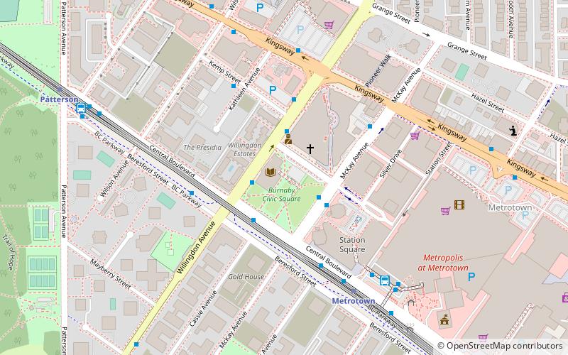
- Calculate routeWillingdon Ave at Central Blvd 2 min walk
- Calculate routeMcKay Ave at Kingsborough St 2 min walk
- Calculate routeCentral Blvd at Willingdon Ave 2 min walk
- Calculate routeKingsway at Willingdon Avenue 5 min walk
- Calculate routeMetrotown Station Bay 2 6 min walk
- Calculate routeMetrotown 5 min walk
- Calculate routePatterson 9 min walk
- Calculate routeRoyal Oak 25 min walk
- Calculate routeJoyce–Collingwood 35 min walk
Day trips


Frequently Asked Questions (FAQ)
Which popular attractions are close to Burnaby Public Library?
Nearby attractions include Metrotown, Burnaby (6 min walk), Central Park, Burnaby (14 min walk).
How to get to Burnaby Public Library by public transport?
The nearest stations to Burnaby Public Library:
Bus
Trolleybus
Metro
Bus
- Willingdon Ave at Central Blvd • Lines: 130 (2 min walk)
- McKay Ave at Kingsborough St • Lines: 119 (2 min walk)
Trolleybus
- Kingsway at Willingdon Avenue • Lines: 19 (5 min walk)
- Metrotown Station Bay 2 • Lines: 19 (6 min walk)
Metro
- Metrotown • Lines: Expo Line (5 min walk)
- Patterson • Lines: Expo Line (9 min walk)