Calgary Centre, Calgary
Map
Facts and practical information
Calgary Centre is a federal electoral district in Alberta, Canada, that has been represented in the House of Commons of Canada since 1968. The riding consists of many young adults who have a relatively high average household income and education level. As the riding encompasses the downtown core and large swaths of apartment blocks in the communities west and south of downtown, Calgary Centre has a low home ownership rate compared to the rest of Canada. ()
Address
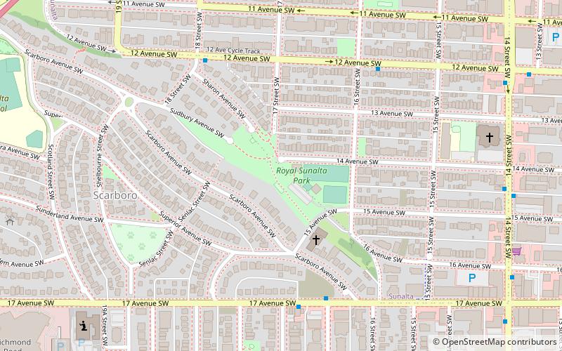
Southwest Calgary (Sunalta)Calgary
ContactAdd
Social media
Add
Getting there by public transportation
Public transportation stops near this location
- Bus
- Light rail
 Bus
Bus
- Calculate route17 Avenue & 16A Street SW 5 min walk
- Calculate route14 Street & 14 Avenue SW 8 min walk
- Calculate route14 Street & 15 Avenue SW 8 min walk
- Calculate routeSunalta 9 min walk
- Calculate routeDowntown West–Kerby 21 min walk
- Calculate routeShaganappi Point 27 min walk
- Calculate route8 Street Southwest 28 min walk
Day trips


Frequently Asked Questions (FAQ)
Which popular attractions are close to Calgary Centre?
Nearby attractions include Scarboro, Calgary (6 min walk), Sunalta, Calgary (7 min walk), Sunalta Station Place, Calgary (7 min walk), Millennium Park, Calgary (16 min walk).
How to get to Calgary Centre by public transport?
The nearest stations to Calgary Centre:
Bus
Light rail
Bus
- 17 Avenue & 16A Street SW • Lines: 2, 6 (5 min walk)
- 14 Street & 14 Avenue SW • Lines: 6 (8 min walk)
Light rail
- Sunalta • Lines: 202 (9 min walk)
- Downtown West–Kerby • Lines: 202 (21 min walk)