The Bunkhouse, Vancouver
Map
Facts and practical information
The Bunkhouse Coffeehouse, downstairs at 612 Davie Street in Vancouver, British Columbia, Canada, was an influential venue for folk music and poetry readings in the 1960s. ()
Coordinates: 49°16'36"N, 123°7'32"W
Address
Downtown VancouverVancouver
ContactAdd
Social media
Add
Getting there by public transportation
Public transportation stops near this location
- Metro
- Bus
- Trolleybus
- Train
- Ferry
 Metro
Metro
- Calculate routeGranville St at Davie St 2 min walk
- Calculate routeDavie St at Granville St 2 min walk
- Calculate routeGranville St at Davie St 2 min walk
- Calculate routePacific St at Richards Street 6 min walk
- Calculate routeHowe Street at Nelson Street 6 min walk
- Calculate routeYaletown–Roundhouse 6 min walk
- Calculate routeVancouver City Centre 13 min walk
- Calculate routeGranville 17 min walk
- Calculate routeDavid Lam Park Terminal 11 min walk
- Calculate routeHornby Terminal 11 min walk
- Calculate routeGranville Island Terminal 12 min walk
- Calculate routeYaletown Dock 13 min walk
- Calculate routeWaterfront 24 min walk
Maps SkyTrain
SkyTrainDay trips
The Bunkhouse – popular in the area (distance from the attraction)
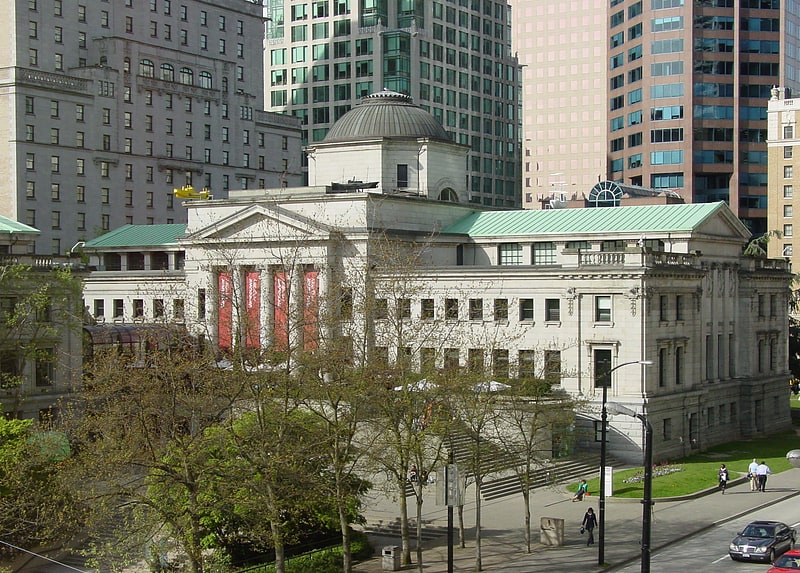
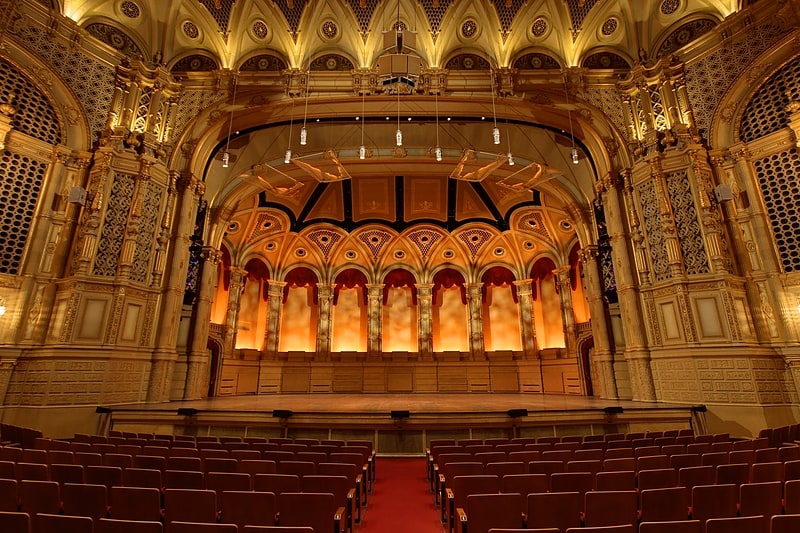
Nearby attractions include: Commodore Ballroom, Celebrities Nightclub, Vancouver Art Gallery, Numbers.


Frequently Asked Questions (FAQ)
Which popular attractions are close to The Bunkhouse?
Nearby attractions include Seymour Wellness Society, Vancouver (5 min walk), Yaletown, Vancouver (6 min walk), Vancouver House, Vancouver (7 min walk), Contemporary Art Gallery, Vancouver (7 min walk).
How to get to The Bunkhouse by public transport?
The nearest stations to The Bunkhouse:
Trolleybus
Bus
Metro
Ferry
Train
Trolleybus
- Granville St at Davie St • Lines: 10, 14, 16, 4, 7 (2 min walk)
- Davie St at Granville St • Lines: 6 (2 min walk)
Bus
- Granville St at Davie St • Lines: 50 (2 min walk)
- Pacific St at Richards Street • Lines: 23 (6 min walk)
Metro
- Yaletown–Roundhouse • Lines: Canada Line (6 min walk)
- Vancouver City Centre • Lines: Canada Line (13 min walk)
Ferry
- David Lam Park Terminal • Lines: Aquabus, False Creek Ferries Route 3 (11 min walk)
- Hornby Terminal • Lines: Aquabus (11 min walk)
Train
- Waterfront (24 min walk)