St. Michael's College, Toronto
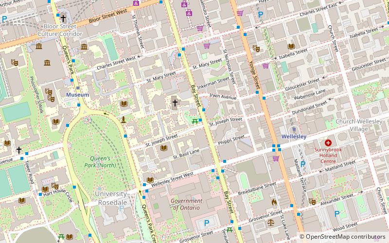
Map
Facts and practical information
The University of St. Michael's College is a college of the University of Toronto, founded in 1852 by the Congregation of St. Basil of Annonay, France. While mainly an undergraduate college for liberal arts and sciences, St. Michael's retains its Catholic affiliation through its postgraduate theology faculty. ()
Getting there by public transportation
Public transportation stops near this location
- Metro
- Bus
- Tram
 Metro
Metro
- Calculate routeSt. Joseph Street 1 min walk
- Calculate routeBay Street 3 min walk
- Calculate routeWellesley 6 min walk
- Calculate routeMuseum 7 min walk
- Calculate routeBay 9 min walk
- Calculate routeBloor-Yonge 10 min walk
- Calculate routeBay Street 10 min walk
- Calculate routeElizabeth Street 10 min walk
- Calculate routeYonge Street 11 min walk
Maps SubwayMaps
 Streetcar systemMaps
 PATH
PATH
SubwayMapsStreetcar systemMapsPATHDay trips
St. Michael's College – popular in the area (distance from the attraction)
Nearby attractions include: Mink Mile, Manulife Centre, Philosopher's Walk, Paul Kane House.


Frequently Asked Questions (FAQ)
Which popular attractions are close to St. Michael's College?
Nearby attractions include St. Basil's Church, Toronto (2 min walk), Victoria University, Toronto (4 min walk), Pontifical Institute of Mediaeval Studies, Toronto (4 min walk), Macdonald Block Complex, Toronto (5 min walk).
How to get to St. Michael's College by public transport?
The nearest stations to St. Michael's College:
Bus
Metro
Tram
Bus
- St. Joseph Street • Lines: 19 (1 min walk)
- Bay Street • Lines: 94A (3 min walk)
Metro
- Wellesley • Lines: 1 (6 min walk)
- Museum • Lines: 1 (7 min walk)
Tram
- Bay Street • Lines: 306, 506 (10 min walk)
- Elizabeth Street • Lines: 306, 506 (10 min walk)