Thorncliffe, Calgary
Map
Facts and practical information
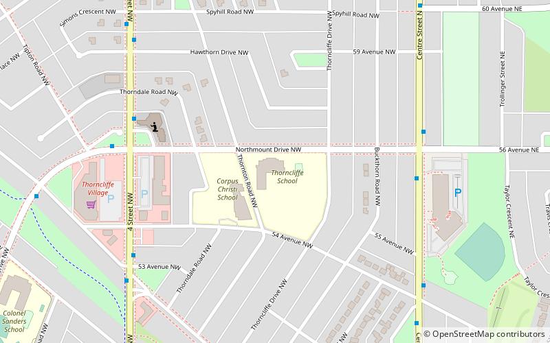
Thorncliffe is a residential neighbourhood in the northwest quadrant of Calgary, Alberta. It is bounded by 64 Avenue to the north, Deerfoot Trail to the east, McKnight Boulevard to the south and 14 Street West and Nose Hill Park to the west. ()
Area: 1.26 mi²Coordinates: 51°6'8"N, 114°4'1"W
Getting there by public transportation
Public transportation stops near this location
- Bus
 Bus
Bus
- Calculate routeSB Centre ST N @ 56 AV N 6 min walk
- Calculate routeSB Centre ST N @ 64 AV N 15 min walk
- Calculate route8998 - EB Norfolk DR @ Thornaby CR NW 17 min walk
- Calculate route8994 - WB Norfolk DR @ Thornwood PL NW 17 min walk
Day trips

Frequently Asked Questions (FAQ)
How to get to Thorncliffe by public transport?
The nearest stations to Thorncliffe:
Bus
Bus
- SB Centre ST N @ 56 AV N • Lines: 300, 301 (6 min walk)
- SB Centre ST N @ 64 AV N • Lines: 300, 301, 901, 902 (15 min walk)