Regal Heights, Toronto

Gallery (2)
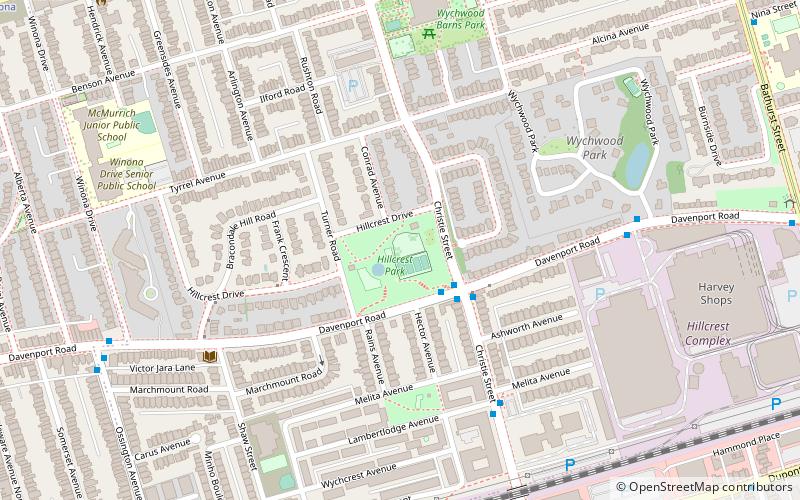
Map

Map
Gallery
Facts and practical information
Regal Heights is a neighbourhood located in Toronto, Ontario, Canada. It is classified as a part of the Corso Italia-Davenport neighbourhood by the City of Toronto. and is situated on the western crest of the Davenport escarpment. This neighbourhood has many distinguishing characteristics including very large turn of the century houses, winding tree- lined streets, and an elevation atop the Davenport escarpment that offers many home owners excellent views of the Toronto skyline. Its main commercial shopping area is along St. Clair Avenue West between Dufferin Street and Oakwood Avenue. ()
Coordinates: 43°40'34"N, 79°25'28"W
Address
Midtown (Bracondale Hill)Toronto
ContactAdd
Social media
Add
Getting there by public transportation
Public transportation stops near this location
- Metro
- Bus
- Tram
 Metro
Metro
- Calculate routeDavenport Road 3 min walk
- Calculate routeMelvina Avenue 5 min walk
- Calculate routeLambertlodge Avenue 6 min walk
- Calculate routeChristie Street 10 min walk
- Calculate routeArlington Avenue 11 min walk
- Calculate routeWychwood 11 min walk
- Calculate routeWinona 13 min walk
- Calculate routeSt. Clair West 19 min walk
- Calculate routeDupont 23 min walk
- Calculate routeChristie 23 min walk
- Calculate routeOssington 25 min walk
Maps SubwayMaps
 Streetcar systemMaps
 PATH
PATH
SubwayMapsStreetcar systemMapsPATHDay trips


Frequently Asked Questions (FAQ)
Which popular attractions are close to Regal Heights?
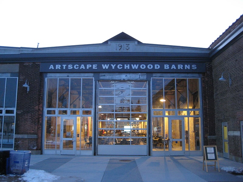
Nearby attractions include Bracondale Hill, Toronto (1 min walk), Wychwood Park, Toronto (7 min walk), Wychwood Barns, Toronto (9 min walk), The Elephant House, Toronto (12 min walk).
How to get to Regal Heights by public transport?
The nearest stations to Regal Heights:
Bus
Tram
Metro
Bus
- Davenport Road • Lines: 126 (3 min walk)
- Melvina Avenue • Lines: 126 (5 min walk)
Tram
- Christie Street • Lines: 512 (10 min walk)
- Arlington Avenue • Lines: 512 (11 min walk)
Metro
- St. Clair West • Lines: 1 (19 min walk)
- Dupont • Lines: 1 (23 min walk)