Old Citadel, Edmonton
Facts and practical information
The Starlite Room is a 1925 brick building in Downtown Edmonton, Alberta, Canada, one block south of Jasper Avenue, the city's main street. The building was originally built as a "citadel" for the Salvation Army. By 1965 it was converted into the first venue of the Citadel Theatre company, with the company taking its name from the name of the building. After the company moved to a new purpose-built theatre building on Churchill Square in 1978, the building was converted to a concert hall and bar. The concert venue inside was for many years named the Rev Cabaret. Under this name, it hosted a variety of concerts including early 1990s shows of then-unknown American bands Nirvana and Green Day. In 2003 the Rev closed, and was reopened as the Starlite Room in 2004, which operates as a members-only club. The lounge/bar downstairs is called "River City Revival House" which opened in 2018. ()
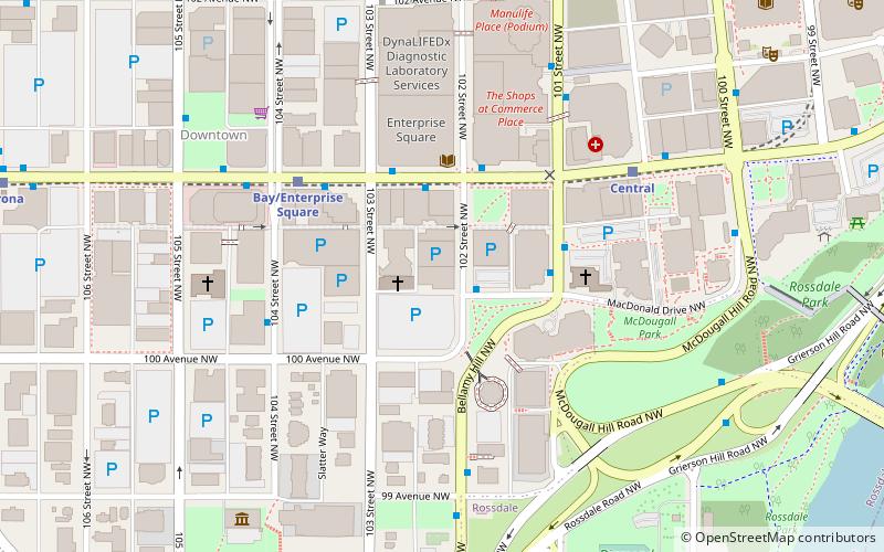
10030 102 St NWNorth Central Edmonton (Downtown Edmonton)Edmonton T5J 0V6
- Bus
- Light rail
 Bus
Bus
- Calculate route102 Street & MacDonald Drive 1 min walk
- Calculate route103 Street & Jasper Ave 3 min walk
- Calculate route101 Street & MacDonald Drive 3 min walk
- Calculate routeRed Arrow Bus Station 4 min walk
- Calculate routeBay/Enterprise Square 4 min walk
- Calculate routeCentral 5 min walk
- Calculate routeCorona 10 min walk
- Calculate routeChurchill 11 min walk


Frequently Asked Questions (FAQ)
Which popular attractions are close to Old Citadel?
How to get to Old Citadel by public transport?
Bus
- 102 Street & MacDonald Drive • Lines: 1 (1 min walk)
- 103 Street & Jasper Ave • Lines: 2, 5, 560, 900X (3 min walk)
Light rail
- Bay/Enterprise Square • Lines: 501, 502 (4 min walk)
- Central • Lines: 501, 502 (5 min walk)