People's Park, Nanning
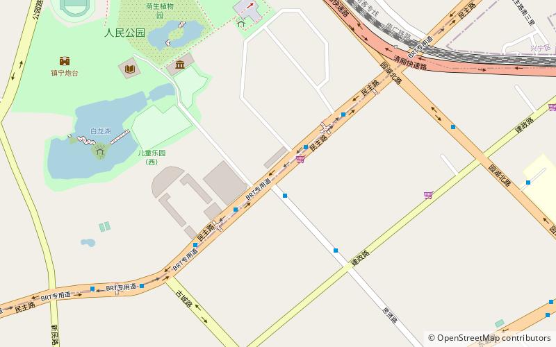
Map
Facts and practical information
People's Park is an urban public park in central Nanning, the capital of Guangxi Zhuang Autonomous Region in southern China. It is also known as White Dragon Park because of the White Dragon Lake inside the park. ()
Elevation: 305 ft a.s.l.Coordinates: 22°49'38"N, 108°19'52"E
Getting there by public transportation
Public transportation stops near this location
- Metro
- Bus
 Metro
Metro
- Calculate routeMINZU Square 21 min walk
- Calculate routeXinmin Lu 25 min walk
- Calculate routeCHAOYANG Square 27 min walk
- Calculate routeMacun 29 min walk
- Calculate route民族古城路口 21 min walk
- Calculate route民族广场 22 min walk
- Calculate route民族星湖北一里 24 min walk
- Calculate routeNanning International Tourism Distribution Center 24 min walk
Day trips


Frequently Asked Questions (FAQ)
How to get to People's Park by public transport?
The nearest stations to People's Park:
Metro
Bus
Metro
- MINZU Square • Lines: 1 (21 min walk)
- Xinmin Lu • Lines: 1 (25 min walk)
Bus
- 民族古城路口 • Lines: 6 (21 min walk)
- 民族广场 • Lines: 32 (22 min walk)