Nanning Mosque, Nanning

Gallery (1)
Map
Map
Facts and practical information
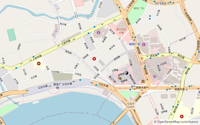
The Nanning Mosque is a mosque in Xingning District, Nanning City, Guangxi, China. ()
Getting there by public transportation
Public transportation stops near this location
- Metro
- Bus
- Train
 Metro
Metro
- Calculate routeCHAOYANG Square 6 min walk
- Calculate routeXinmin Lu 15 min walk
- Calculate routeNanning Theater 21 min walk
- Calculate route民族广场 19 min walk
- Calculate route新民七星路口 22 min walk
- Calculate routeNanning International Tourism Distribution Center 23 min walk
- Calculate route新民桃源路口 24 min walk
- Calculate routeNanning 23 min walk
Day trips


Frequently Asked Questions (FAQ)
How to get to Nanning Mosque by public transport?
The nearest stations to Nanning Mosque:
Metro
Bus
Train
Metro
- CHAOYANG Square • Lines: 1, 2 (6 min walk)
- Xinmin Lu • Lines: 1 (15 min walk)
Bus
- 民族广场 • Lines: 32 (19 min walk)
- 新民七星路口 • Lines: 32 (22 min walk)
Train
- Nanning (23 min walk)