People's Park, Nanchang
Map
Facts and practical information
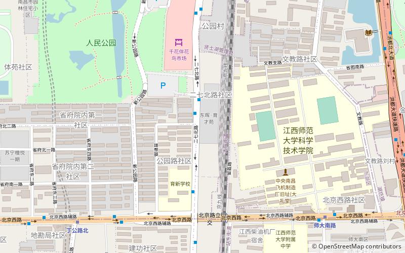
People's Park is an urban public park in Donghu District of central Nanchang, capital of Jiangxi province, China. Covering an area of 32.6 hectares, it is the largest park in downtown Nanchang. It has more than 14,000 trees of 175 different species. Its layout is in the style of typical Chinese gardens of the Jiangnan region. It is popular with local residents and tourists alike. ()
Created: 1954Elevation: 85 ft a.s.l.Coordinates: 28°40'51"N, 115°54'50"E
Address
Nanchang
ContactAdd
Social media
Add
Getting there by public transportation
Public transportation stops near this location
- Metro
- Bus
- Train
 Metro
Metro
- Calculate routeShidanan Road 10 min walk
- Calculate routeDinggong Road North 11 min walk
- Calculate route人民公园 16 min walk
- Calculate routePengjiaqiao 23 min walk
- Calculate route南京西路贤士二路口 15 min walk
- Calculate route广场东路丁公路口 16 min walk
- Calculate route南柴 19 min walk
- Calculate routeNanchang 28 min walk
Day trips


Frequently Asked Questions (FAQ)
How to get to People's Park by public transport?
The nearest stations to People's Park:
Metro
Bus
Train
Metro
- Shidanan Road • Lines: 1 (10 min walk)
- Dinggong Road North • Lines: 1, 4 (11 min walk)
Bus
- 南京西路贤士二路口 • Lines: 5 (15 min walk)
- 广场东路丁公路口 • Lines: 232路 (16 min walk)
Train
- Nanchang (28 min walk)