Nanchang Bayi Stadium, Nanchang
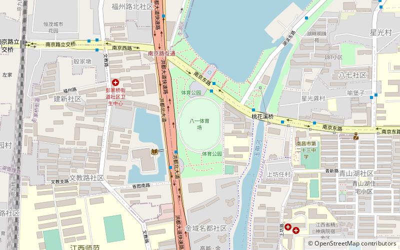
Map
Facts and practical information
Address
Nanchang
ContactAdd
Social media
Add
Getting there by public transportation
Public transportation stops near this location
- Metro
- Bus
 Metro
Metro
- Calculate route南京路口 3 min walk
- Calculate route省科学院 7 min walk
- Calculate route南京西路文教路口 9 min walk
- Calculate route南昌大学青山湖校区北区 15 min walk
- Calculate routeShidanan Road 16 min walk
- Calculate routePengjiaqiao 16 min walk
- Calculate route青山湖西 21 min walk
- Calculate routeGuowei Road 24 min walk
Day trips


Frequently Asked Questions (FAQ)
How to get to Nanchang Bayi Stadium by public transport?
The nearest stations to Nanchang Bayi Stadium:
Bus
Metro
Bus
- 南京路口 • Lines: 5 (3 min walk)
- 省科学院 • Lines: 5 (7 min walk)
Metro
- Shidanan Road • Lines: 1 (16 min walk)
- Pengjiaqiao • Lines: 1 (16 min walk)