Wuhan Institute of Technology, Wuhan
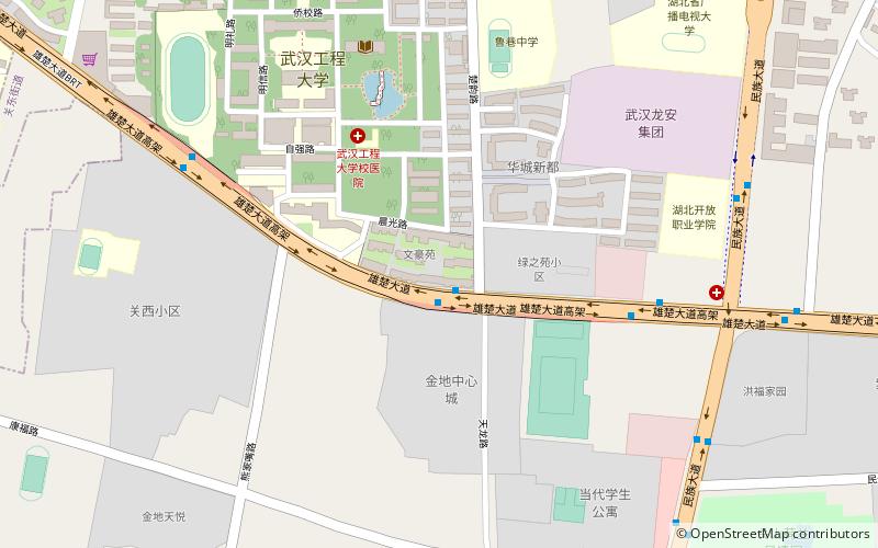
Map
Facts and practical information
Wuhan Institute of Technology is a university in Wuhan, Hubei province, China. ()
Getting there by public transportation
Public transportation stops near this location
- Metro
- Bus
- Tram
 Metro
Metro
- Calculate route雄楚大道华城新都站 1 min walk
- Calculate route民族大道时间广场站 10 min walk
- Calculate routeOptics Valley Square 15 min walk
- Calculate routeYangjiawan 20 min walk
- Calculate routeWalking Street and Hospital of Traditional Chinese Medicine 26 min walk
- Calculate routeChangqingtang Road 27 min walk
- Calculate routeXinzhu Road 33 min walk
- Calculate routeHuazhong University of Science and Technology 33 min walk
Day trips


Frequently Asked Questions (FAQ)
How to get to Wuhan Institute of Technology by public transport?
The nearest stations to Wuhan Institute of Technology:
Bus
Metro
Tram
Bus
- 雄楚大道华城新都站 • Lines: 529 (1 min walk)
- 民族大道时间广场站 • Lines: 405, 538, 572, 732 (10 min walk)
Metro
- Optics Valley Square • Lines: 2 (15 min walk)
- Yangjiawan • Lines: 2 (20 min walk)
Tram
- Walking Street and Hospital of Traditional Chinese Medicine • Lines: L1 (26 min walk)
- Changqingtang Road • Lines: L1 (27 min walk)