Wusong, Shanghai
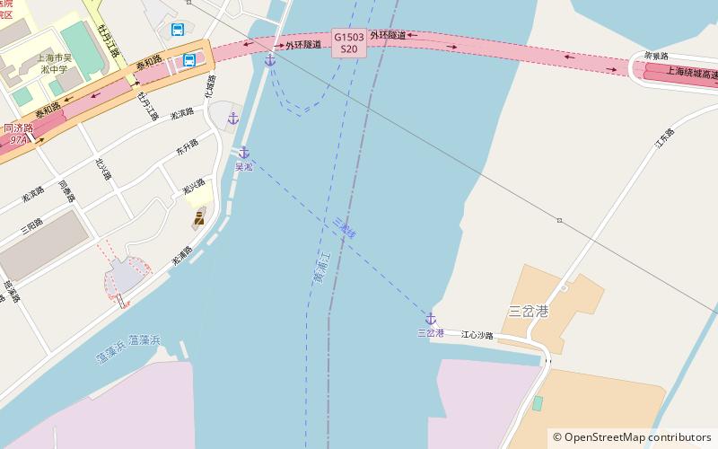
Map
Facts and practical information
Wusong, formerly romanized as Woosung, is a subdistrict of Baoshan in northern Shanghai. Prior to the city's expansion, it was a separate port town located 14 miles down the Huangpu River from Shanghai's urban core. ()
Address
浦东 (高桥)Shanghai
ContactAdd
Social media
Add
Getting there by public transportation
Public transportation stops near this location
- Metro
- Bus
 Metro
Metro
- Calculate routeWusong Passenger Coach Terminal 9 min walk
- Calculate routeMudanjiang Road Songbao Road 15 min walk
- Calculate routeHaibin Bacun 19 min walk
- Calculate routeSongbin Road 18 min walk
- Calculate routeZhanghuabang 28 min walk
- Calculate routeShuichan Road 29 min walk
Day trips


Frequently Asked Questions (FAQ)
How to get to Wusong by public transport?
The nearest stations to Wusong:
Bus
Metro
Bus
- Wusong Passenger Coach Terminal (9 min walk)
- Mudanjiang Road Songbao Road • Lines: 宝山1 (15 min walk)
Metro
- Songbin Road • Lines: 3 (18 min walk)
- Zhanghuabang • Lines: 3 (28 min walk)