Cerro Machín

Gallery (2)
Map
Map
Gallery
Facts and practical information
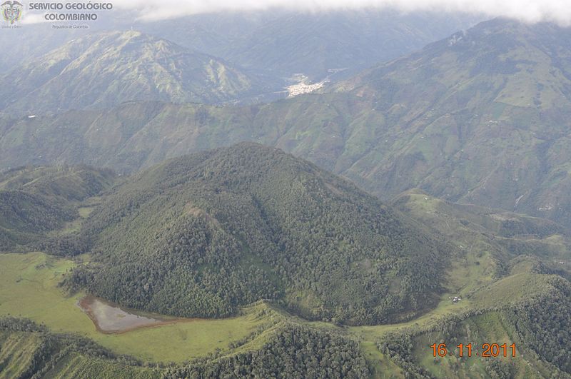
Cerro Machín is a stratovolcano located in Tolima Department, Colombia. Cerro Machin is a volcanic plug that is approximately the same age as the Ruiz-Tolima Massif and has the appearance of being part of that volcanic system. Its sisters are Nevado del Tolima, 17,060 feet; Santa Isabel, 16,240 feet, Nevado del Ruiz, 17,457 feet, plus nine other lesser volcanoes and a 10,000 feet volcanic South Wall containing in excess of thirty volcanic domes. ()
Location
Tolima
ContactAdd
Social media
Add