Plzeň-City District, Pilsen
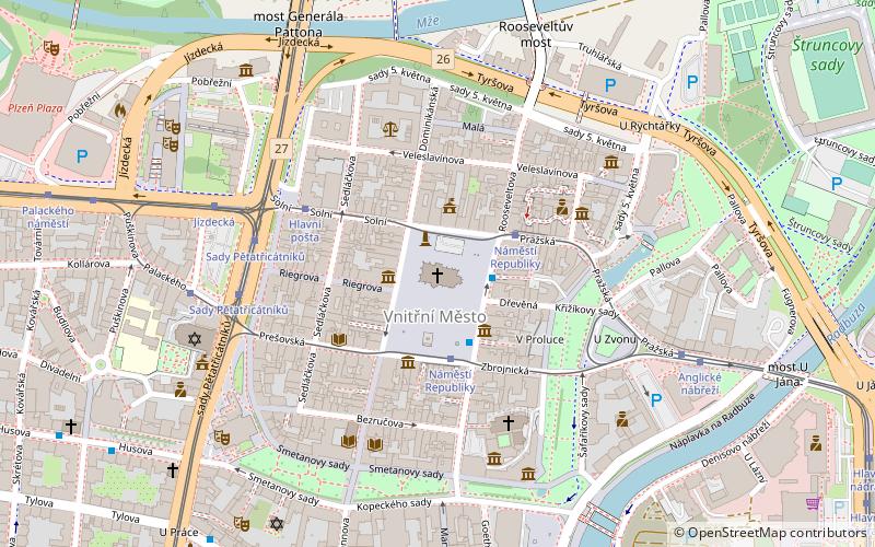
Map
Facts and practical information
Plzeň-City District is a district within Plzeň Region of the Czech Republic. Its capital is Plzeň. ()
Address
Plzen 3 (Historické Centrum)Pilsen
ContactAdd
Social media
Add
Getting there by public transportation
Public transportation stops near this location
- Bus
- Trolleybus
- Tram
- Train
 Bus
Bus
- Calculate routeNáměstí Republiky 2 min walk
- Calculate routeGoethova 7 min walk
- Calculate routeMrakodrap 8 min walk
- Calculate routeU Práce 8 min walk
- Calculate routeNáměstí Republiky 2 min walk
- Calculate routeHlavní pošta 4 min walk
- Calculate routeSady Pětatřicátníků 5 min walk
- Calculate routeGoethova 7 min walk
- Calculate routeMrakodrap 8 min walk
- Calculate routeU Práce 8 min walk
- Calculate routeProkopova 10 min walk
- Calculate routePlzeň hlavní nádraží 14 min walk
- Calculate routePlzeň-Jižní předměstí 18 min walk
- Calculate routePlzeň zastávka 19 min walk
Day trips


Frequently Asked Questions (FAQ)
Which popular attractions are close to Plzeň-City District?
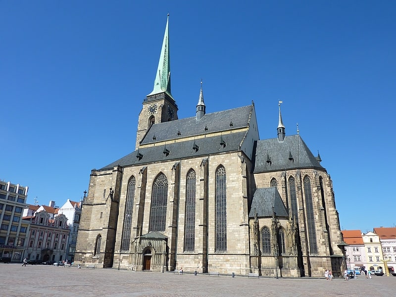
Nearby attractions include Cathedral of St. Bartholomew, Pilsen (1 min walk), Náměstí Republiky, Pilsen (2 min walk), City Hall, Pilsen (2 min walk), Nanebevzetí Panny Marie, Pilsen (4 min walk).
How to get to Plzeň-City District by public transport?
The nearest stations to Plzeň-City District:
Bus
Tram
Trolleybus
Train
Bus
- Náměstí Republiky • Lines: 20, 33, 40, N1, N4 (2 min walk)
- Goethova • Lines: 20, 33, 40 (7 min walk)
Tram
- Náměstí Republiky (2 min walk)
- Hlavní pošta (4 min walk)
Trolleybus
- Goethova • Lines: 13, 14 (7 min walk)
- Mrakodrap • Lines: 10, 11, 12, 15, 16, 17 (8 min walk)
Train
- Plzeň hlavní nádraží (14 min walk)
- Plzeň-Jižní předměstí (18 min walk)