Lungholm, Lolland
Map
Facts and practical information
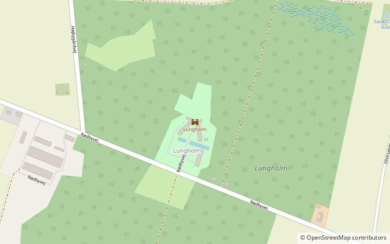
Lungholm is a manor house and estate located on the island of Lolland in southeastern Denmark. It has been owned by members of the Lehn family since 1784. The three-winged main building was listed on the Danish registry of protected buildings and places in 1988. It consists of a main wing from 1856 and two side wings from the 16th or early 17th century. ()
Architectural style: NeoclassicismCoordinates: 54°40'19"N, 11°27'36"E
Getting there by public transportation
Public transportation stops near this location
- Train
 Train
Train
- Calculate routeLolland 34 min walk
Day trips


Frequently Asked Questions (FAQ)
Which popular attractions are close to Lungholm?
Nearby attractions include Polakkasernen, Lolland (10 min walk), Olstrup Kirke, Lolland (10 min walk), Tågerup Church, Lolland (14 min walk).
How to get to Lungholm by public transport?
The nearest stations to Lungholm:
Train
Train
- Lolland (34 min walk)