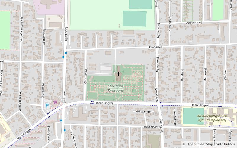
Christianskirken, Fredericia

Gallery (1)
Map
Map
Facts and practical information
Christianskirken (address: Christiansvej 4) is a place located in Fredericia (Syddanmark region) and belongs to the category of church.
It is situated at an altitude of 82 feet, and its geographical coordinates are 55°34'47"N latitude and 9°45'28"E longitude.
Planning a visit to this place, one can easily and conveniently get there by public transportation. Christianskirken is a short distance from the following public transport stations: Treldevej v Thorvaldsensvej (bus, 20 min walk), Fredericia (train, 27 min walk).
Among other places and attractions worth visiting in the area are: Fredericia Vold (architecture, 19 min walk), Det Hvide Vandtårn (museum, 20 min walk), Vendersgade (square, 24 min walk).
Coordinates: 55°34'47"N, 9°45'28"E
Getting there by public transportation
Public transportation stops near this location
- Bus
- Train
 Bus
Bus
- Calculate routeTreldevej v Thorvaldsensvej 20 min walk
- Calculate routeNordre Kobbelvej 26 min walk
- Calculate routeFredericia Banegård 28 min walk
- Calculate routeFredericia 27 min walk
Day trips


Frequently Asked Questions (FAQ)
Which popular attractions are close to Christianskirken?
Nearby attractions include Fredericia Vold, Fredericia (19 min walk), Det Hvide Vandtårn, Fredericia (20 min walk), Vendersgade, Fredericia (24 min walk).
How to get to Christianskirken by public transport?
The nearest stations to Christianskirken:
Bus
Train
Bus
- Treldevej v Thorvaldsensvej • Lines: 2, 6 (20 min walk)
- Nordre Kobbelvej • Lines: 6 (26 min walk)
Train
- Fredericia (27 min walk)