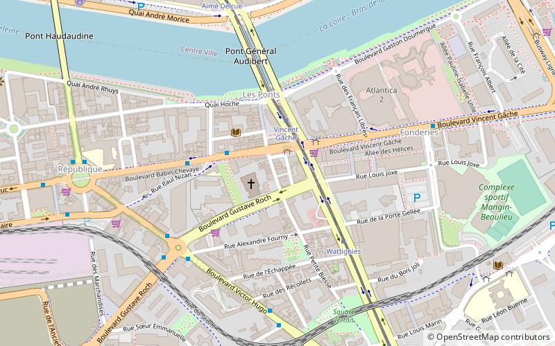
Emplacement de l'aumônerie de Toussaints, Nantes
Map

Map

Facts and practical information
Île de Grande Biesse is one of the former islands of the Loire River in Nantes, corresponding today to the northern part of the island of Nantes.
Coordinates: 47°12'19"N, 1°32'55"W
Address
Île de Nantes (République - Les Ponts)Nantes
ContactAdd
Social media
Add
Day trips
Emplacement de l'aumônerie de Toussaints – popular in the area (distance from the attraction)
Nearby attractions include: Passage Pommeraye, Nantes Cathedral, Château des ducs de Bretagne, Tomb of Francis II.
Frequently Asked Questions (FAQ)
Which popular attractions are close to Emplacement de l'aumônerie de Toussaints?
Nearby attractions include Île de Nantes, Nantes (3 min walk), St. Magdalene Church, Nantes (5 min walk), Les Machines de l'Île, Nantes (15 min walk), Nantes–Brest canal, Nantes (16 min walk).
How to get to Emplacement de l'aumônerie de Toussaints by public transport?
The nearest stations to Emplacement de l'aumônerie de Toussaints:
Bus
Tram
Train
Ferry
Bus
- Vincent Gâche • Lines: 5 (2 min walk)
- Nizan • Lines: 5 (3 min walk)
Tram
- Vincent Gâche • Lines: 2, 3 (2 min walk)
- Wattignies • Lines: 2, 3 (4 min walk)
Train
- Rezé - Pont-Rousseau (22 min walk)
- Nantes (23 min walk)
Ferry
- Gare Maritime • Lines: N1 (30 min walk)
- Hangar à Bananes • Lines: N2, N2 Hangar à Bananes → Bas-Chante (32 min walk)


