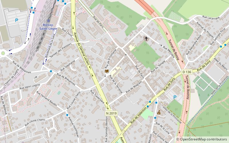
Boissy-Saint-Léger, Paris

Gallery (1)
Map
Map
Facts and practical information
Address
Boissy-Saint-LégerParis
ContactAdd
Social media
Add
Getting there by public transportation
Public transportation stops near this location
- Bus
- Train
 Bus
Bus
- Calculate routeMairie 6 min walk
- Calculate routeHenri Legros 6 min walk
- Calculate routeLouise Chenu 6 min walk
- Calculate routeBoissy-Saint-Léger 8 min walk
Maps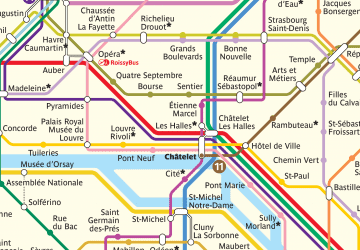 Metro
Metro
MetroDay trips


Frequently Asked Questions (FAQ)
How to get to Boissy-Saint-Léger by public transport?
The nearest stations to Boissy-Saint-Léger:
Bus
Train
Bus
- Mairie • Lines: 5 (6 min walk)
- Henri Legros • Lines: 51 (6 min walk)
Train
- Boissy-Saint-Léger (8 min walk)