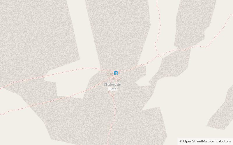
Refuge de Platé
#1372 among destinations in France
![Refuge de Platé location map](https://tzmedia.b-cdn.net/media/images/static-maps/fr/45_9656_6_7173.jpg)
Facts and practical information
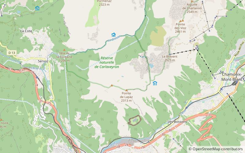
Refuge de Platé is a refuge located on the "Tour des Fiz", in Haute Savoie, facing Mont Blanc in the Alps. ()
Les FizsAuvergne-Rhône-AlpesFrance
Refuge de Platé – popular in the area (distance from the attraction)
Nearby attractions include: Lac Vert, Tête du Colonney, Lac de Pormenaz, Église Notre-Dame de Toute Grâce du Plateau d'Assy.
2.1 miSENatural attraction, Body of water, ParkLac Vert, Passy
54 min walk • Lac Vert is a lake in the municipality of Passy, Haute-Savoie, France.
1.3 miWNature, Natural attraction, MountainTête du Colonney, Flaine
34 min walk • Tête du Colonney is a mountain in the Chablais Alps in Haute-Savoie, France. Standing above the Plateau d'Assy, the mountain provides unobscured views of Mont Blanc to the southeast from its summit. It can be reached by cable car in the winter from Flaine.
3.7 miENatural attraction, LakeLac de Pormenaz, Passy National Nature Reserve
95 min walk • Lac de Pormenaz is an alpine lake in the Passy National Nature Preserve of the Haute-Savoie department of France. Its surface area of 4.4 ha is at an elevation of 1945 m. The lake can be reached by foot from the village of Plaine Joux above Servoz.
1.8 miSChurchÉglise Notre-Dame de Toute Grâce du Plateau d'Assy, Passy
47 min walk • The church of Notre-Dame de Toute Grâce du Plateau d'Assy is a Roman Catholic church in France, constructed on the plateau d'Assy between 1937 and 1946. It faces Mont Blanc, and is within the territory of the commune of Passy, in the Haute-Savoie department.
4.9 miSView pointThermes de Saint Gervais Mont-Blanc, Saint-Gervais-les-Bains
125 min walk • The Thermes de Saint Gervais Mont-Blanc is a spa organized around thermal springs, located in the valley of the Arve, in the hamlet of Fayet, in the municipality of Saint-Gervais-les-Bains in Haute-Savoie.
4.3 miNENatural attraction, Body of water, ParkLac d'Anterne, Passy
109 min walk • Lac d'Anterne is a lake near Sixt-Fer-à-Cheval, in the commune of Passy in the Haute-Savoie department of France. It is located in the Sixt-Passy nature preserve.
4.5 miNEAlpine hut, HikingRefuge Alfred Wills
114 min walk • Refuge Alfred Wills is a mountain hut in the French Alps in Haute-Savoie. The current shelter, bearing the same name, was built in 1981. At 1,808 metres in altitude, it is the site of the former pasture Anterne more commonly called "Cottages Anterne". It is surrounded by five private cottages.
4.3 miNNature, Natural attraction, LakeLac de Gers, Samoëns
109 min walk • Lac de Gers is a lake above Samoëns in Haute-Savoie, France. The lake's water level varies seasonally up by 2 m. Its maximum surface area is 6.5 ha.
3.4 miENatural attraction, MountainPointe d'Anterne, Passy National Nature Reserve
87 min walk • Pointe d'Anterne is a mountain of Haute-Savoie, France. It lies in the Chablais Alps. It has an altitude of 2733 metres above sea level.
3.2 miNWNature, Natural attraction, LakeLac de Flaine, Flaine
83 min walk • Lac de Flaine is a lake at Flaine in Haute-Savoie, France. Its surface and depth vary seasonly. Maximum depth can reach 10.5 m in May and only 0.75 m in winter, while the surface area varies from 12 ha to 1.5 ha.
5.3 miSENature, Natural attraction, LakeLac de l'Aiguillette
136 min walk • Lac de l'Aiguillette is a lake in Haute-Savoie, France.