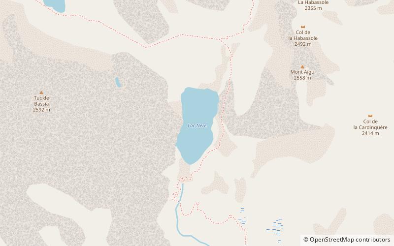
Lac Nère
#618 among destinations in France
![Lac Nère location map](https://tzmedia.b-cdn.net/media/images/static-maps/fr/42_835_-0_20289.jpg)
Facts and practical information
Lac Nère is a lake in Hautes-Pyrénées, France. At an elevation of 2,309 metres, its surface area is 0.02 km2. ()
OccitanieFrance
Lac Nère plan & book
Unleash the traveler in you — discover the cheapest flight deals, find the perfect hotel or hostel nearby, and search for the best car rental prices. Travel at your own pace to discover new places and enjoy your journey.
Lac Nère – popular in the area (distance from the attraction)
Nearby attractions include: Gaube Lake, Lac d'Estaing, Pont d'Espagne, Lac de Suyen.
3.2 miEHigh-altitude lake with mountain viewsGaube Lake, Cauterets
82 min walk • Gaube Lake is a lake in the French Pyrenees, in the department of the Hautes-Pyrénées, near the town of Cauterets.
5 miNNature, Natural attraction, LakeLac d'Estaing
127 min walk • Nestled in the heart of the French Pyrenees, Lac d'Estaing is a serene mountain lake that offers a tranquil escape from the bustle of urban life. Surrounded by lush forests and towering peaks, this picturesque body of water is a jewel of the region, reflecting the...
3.4 miEScenic national park valley and waterfallsPont d'Espagne, Cauterets
87 min walk • Pont d'Espagne is a stone-built bridge that spans the Gave de Marcadau at the point where it meets the Gave de Gaube, near one of its sources high in the French Pyrenees. It is a protected area of the Pyrénées in the Pyrénées National Park.
4.3 miNWNature, Natural attraction, LakeLac de Suyen, Pyrénées National Park
111 min walk • Lac de Suyen is a lake in Hautes-Pyrénées, France. At an elevation of 1536 m, its surface area is 0.02 km².
0.6 miNNature, Natural attraction, LakeLac du Pourtet, Pyrénées National Park
15 min walk • Lac du Pourtet is a lake in Hautes-Pyrénées, France. At an elevation of 2420 m, its surface area is 0.058 km².
2.6 miSWNature, Natural attraction, MountainGrande Fache
66 min walk • La Grande Fache, Gran Facha or Cuspide de Bachimaña is a summit in the Pyrenees, culminating at 3,005 m, situated on the French-Spanish border and on the pyrenean watershed.
5.2 miSENature, Natural attraction, MountainPiton Carré
132 min walk • Le Piton Carré is a summit in the French Pyrenees in the Massif du Vignemale, of which it constitutes the seventh highest peak.
5.2 miSENature, Natural attraction, MountainPointe Chausenque
134 min walk • La Pointe Chausenque, culminating at 3,204 m is a summit in the Massif du Vignemale in the French Pyrenees.
5.4 miSENature, Natural attraction, MountainPetit Vignemale, Pyrénées National Park
138 min walk • The Petit Vignemale is a summit in the French Pyrenees in the massif du Vignemale. Access is possible either by the Gaube valley, or la vallée d'Ossoue.
2.4 miNENature, Natural attraction, LakeLac Bleu d'Ilhéou, Pyrénées National Park
61 min walk • Lac Bleu d'Ilhéou is a lake in Hautes-Pyrénées, France. At an elevation of 1976 m, its surface area is 0.113 km².
5.7 miSENature, Natural attraction, MountainPic de Montferrat, Pyrénées National Park
146 min walk • The Pic de Montferrat, culminating at 3,129 m, is a crest summit on the Franco-Spanish border, in the massif du Vignemale in the Pyrenees.