Charbonnières-les-Bains, Lyon
Map
Facts and practical information
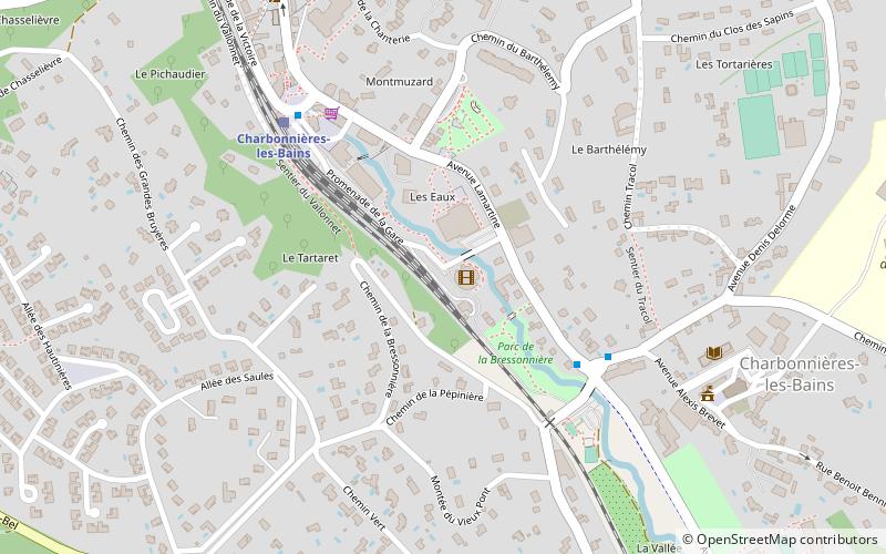
Charbonnières-les-Bains is a commune in the Metropolis of Lyon in Auvergne-Rhône-Alpes region in eastern France. It borders Parc de Lacroix-Laval in Marcy-l'Étoile. ()
Address
Lyon
ContactAdd
Social media
Add
Getting there by public transportation
Public transportation stops near this location
- Bus
- Train
 Bus
Bus
- Calculate routeCharbonnières-les-Bains 6 min walk
- Calculate routeCasino-Lacroix-Laval 17 min walk
- Calculate routeLes Flachères 20 min walk
- Calculate routeLe Méridien 24 min walk
- Calculate routeCampus Région numérique 15 min walk
- Calculate routeAvenue de la Paix 16 min walk
- Calculate routeCharbonnières Les Verrières 18 min walk
- Calculate routeBois de l'Étoile Liberté 21 min walk
Maps Metro
Metro
MetroDay trips


Frequently Asked Questions (FAQ)
How to get to Charbonnières-les-Bains by public transport?
The nearest stations to Charbonnières-les-Bains:
Train
Bus
Train
- Charbonnières-les-Bains (6 min walk)
- Casino-Lacroix-Laval (17 min walk)
Bus
- Campus Région numérique • Lines: 5, 86 (15 min walk)
- Avenue de la Paix • Lines: 5, 86 (16 min walk)