Fort de Villiers, Noisy-le-Grand
Map
Facts and practical information
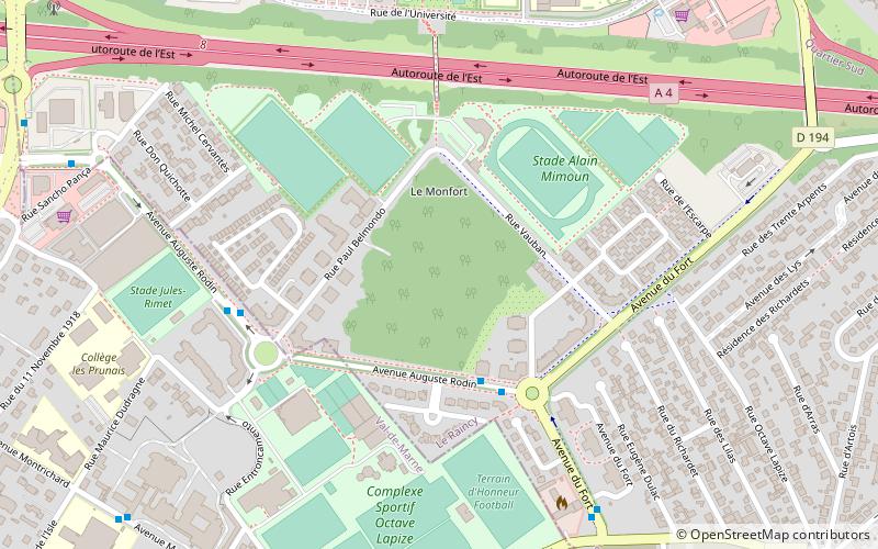
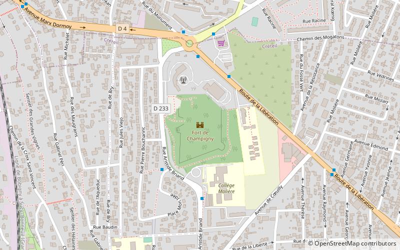
Fort de Villers was built following the Franco-Prussian War to defend Paris. Located to the east of Paris in Villiers-sur-Marne, the fort was part of an outer ring of eighteen major fortifications built in response to improvements in the range and effectiveness of artillery since the construction of the Thiers fortifications of the 1840s. It was built in accordance with improved principles of fortification developed for the Séré de Rivières system. ()
Address
Noisy-le-Grand (Richardets)Noisy-le-Grand
ContactAdd
Social media
Add
Getting there by public transportation
Public transportation stops near this location
- Bus
- Train
 Bus
Bus
- Calculate routeLe Fort 3 min walk
- Calculate routePaul Belmondo 5 min walk
- Calculate routeCité des Hêtres 7 min walk
- Calculate routeLes Stades 9 min walk
- Calculate routeNoisy-le-Grand - Mont d’Est 16 min walk
- Calculate routeVilliers-sur-Marne - Le Plessis-Trévise 24 min walk
- Calculate routeLes Yvris Noisy-le-Grand 34 min walk
- Calculate routeNoisy-Champs 34 min walk
Day trips


Frequently Asked Questions (FAQ)
Which popular attractions are close to Fort de Villiers?
Nearby attractions include Aponia, Noisy-le-Grand (13 min walk), Villiers-sur-Marne, Noisy-le-Grand (15 min walk).
How to get to Fort de Villiers by public transport?
The nearest stations to Fort de Villiers:
Bus
Train
Bus
- Le Fort • Lines: 310 (3 min walk)
- Paul Belmondo • Lines: 310 (5 min walk)
Train
- Noisy-le-Grand - Mont d’Est (16 min walk)
- Villiers-sur-Marne - Le Plessis-Trévise (24 min walk)