Champ de Juillet, Limoges
Map

Map

Facts and practical information
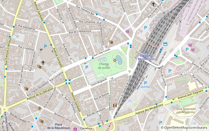
The Champ de Juillet is a park of the city of Limoges, located near the Benedictine station, in the axis joining the latter to the royal place Denis-Dussoubs. It covers 2.7 hectares for the park alone, more than five hectares if we take into account the parking lots.
Area: 6.67 acres (0.0104 mi²)Elevation: 853 ft a.s.l.Coordinates: 45°50'7"N, 1°15'50"E
Day trips
Champ de Juillet – popular in the area (distance from the attraction)
Nearby attractions include: Church of St. Michel des Lions, Limoges Cathedral, Church of St. Pierre du Queyroix, Abbey of Saint Martial.
Frequently Asked Questions (FAQ)
Which popular attractions are close to Champ de Juillet?
Nearby attractions include Laser League, Limoges (8 min walk), Church of St. Pierre du Queyroix, Limoges (8 min walk), Abbey of Saint Martial, Limoges (9 min walk), Pavillon du Verdurier, Limoges (10 min walk).
How to get to Champ de Juillet by public transport?
The nearest stations to Champ de Juillet:
Trolleybus
Bus
Train
Trolleybus
- A. Barbès • Lines: 6 (2 min walk)
- Gare des Bénédictins • Lines: 6 (4 min walk)
Bus
- A. Barbès • Lines: d8 (2 min walk)
- Gare des Bénédictins • Lines: 10, 20, 21, 22, d10, d8 (4 min walk)
Train
- Limoges-Bénédictins (5 min walk)
- Limoges-Montjovis (17 min walk)


