River Gambia National Park Travel Guide
Facts and practical information
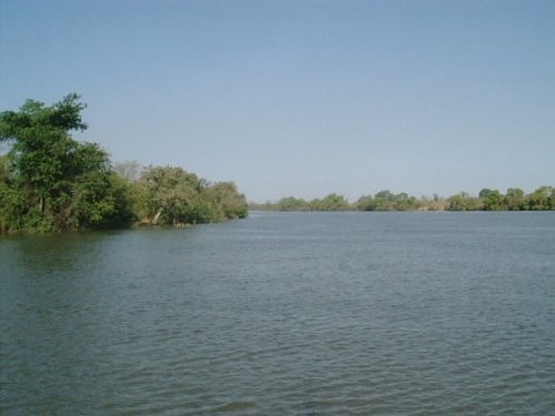
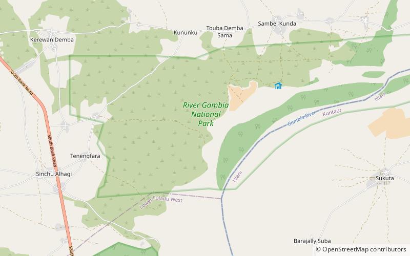
Nestled in the heart of The Gambia, the River Gambia National Park in the Maccarthy Island region is a nature lover's paradise. Spanning over 5,000 square kilometers, this vast and diverse park is home to an incredible array of wildlife and stunning landscapes.
Visitors to the River Gambia National Park have the opportunity to experience the wonders of the African wilderness up close. The park is a haven for birdwatchers, with over 500 species of birds making their home here, including the rare Egyptian plover and African finfoot. In addition to its avian residents, the park is also home to a variety of other wildlife, including monkeys, hippos, crocodiles, and even the elusive manatee.
For those looking to explore the park by water, the River Gambia offers a unique opportunity for boat safaris. Drifting along the tranquil waters, visitors can spot wildlife along the riverbanks and immerse themselves in the natural beauty of the surrounding landscape.
In addition to its natural wonders, the River Gambia National Park also holds cultural significance. The park is home to several historic sites, including the ruins of the 19th century Fort Bullen, which stands as a testament to the region's colonial past.
Maccarthy Island
River Gambia National Park Attractions - What to See and Explore
River Gambia National Park offers many attractions and places to visit. Here are the most important ones: Nyassang Forest Park. Below you will find a complete list of places worth visiting.
Best Time To Visit River Gambia National Park
Learn when is the best time to travel to River Gambia National Park weather-wise and what to expect in each season.
Best Ways to Experience the Park
Wildlife
AnimalsSee what popular animal species you can meet in this location.
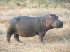
Common Hippopotamus
The hippopotamus, or hippo, is a fascinating and hefty mammal native to Africa, renowned for its massive barrel-shaped body, wide-opening mouth, and almost hairless skin. These semiaquatic giants can weigh around 1,500 kg on average.
Mammals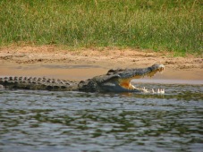
Nile crocodile
The Nile crocodile (Crocodylus niloticus) is one of Africa’s most formidable predators, inhabiting freshwater environments across 26 countries on the continent. Classified as "Least Concern" by the IUCN since 1996, these crocodiles thrive in sub-Saharan Africa...
Reptiles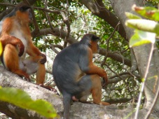
West African Red (Bay) Colobus
The western red colobus, also known as the bay red colobus, rust-red colobus, or Upper Guinea red colobus, is a fascinating Old World monkey inhabiting the forests of West Africa, from Senegal to Ghana. According to Groves (2005), this species is divided into three...
Mammals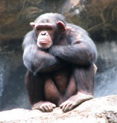
Common chimpanzee
Chimpanzees, often referred to simply as chimps, are fascinating great apes native to tropical Africa. These remarkable creatures are our closest living relatives, sharing the genus Pan with bonobos. They live in complex social groups typically led by males...
Mammals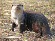
African (Cape) Clawless Otter
The African clawless otter, also known as the Cape clawless otter or groot otter, is the second-largest freshwater otter species. These captivating creatures inhabit savannah and lowland forest areas near permanent water sources throughout most of sub-Saharan Africa...
Mammals