Újlipótváros, Budapest
Map
Facts and practical information
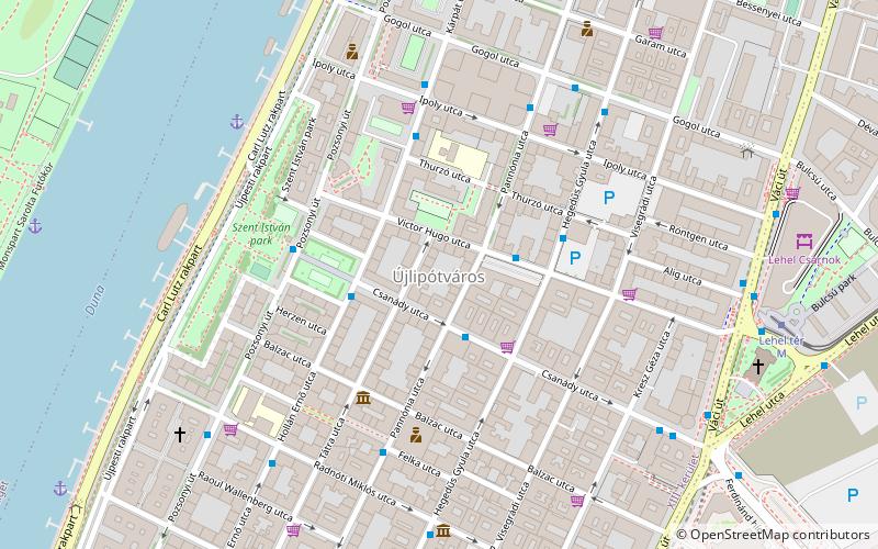
Újlipótváros is a neighborhood in the 13th district of Budapest, Hungary. It is located north to Lipótváros neighbourhood of the 5th District, with the Szent István Boulevard separating it from its southern neighbor, Lipótváros. It lies east of the river Danube, west of Terézváros, and south of Vizafogó. Unlike most other neighborhoods in the 13th district, Újlipótváros is considered part of the Budapest city center. ()
Address
AngyalföldBudapest
ContactAdd
Social media
Add
Getting there by public transportation
Public transportation stops near this location
- Metro
- Bus
- Trolleybus
- Tram
- Light rail
- Train
 Metro
Metro
- Calculate routeVictor Hugo utca 2 min walk
- Calculate routeGogol utca 6 min walk
- Calculate routeRadnóti Miklós utca 6 min walk
- Calculate routeLehel tér M 8 min walk
- Calculate routeLehel tér 8 min walk
- Calculate routeDózsa György út 17 min walk
- Calculate routeKodály körönd 24 min walk
- Calculate routeVörösmarty utca 24 min walk
- Calculate routeLehel tér M 9 min walk
- Calculate routeJászai Mari tér 12 min walk
- Calculate routeDévai utca 13 min walk
- Calculate routeNyugati pályaudvar M 15 min walk
- Calculate routeBudapest-Nyugati 14 min walk
- Calculate routeMargit híd, budai hídfő 19 min walk
- Calculate routeSzépvölgyi út 24 min walk
- Calculate routeBatthyány tér 27 min walk
- Calculate routeTímár utca 31 min walk
- Calculate routeBáthory utca / Bajcsy-Zsilinszky út 20 min walk
- Calculate routeKossuth Lajos tér M 23 min walk
- Calculate routeZichy Jenő utca 23 min walk
- Calculate routeOpera M 27 min walk
Maps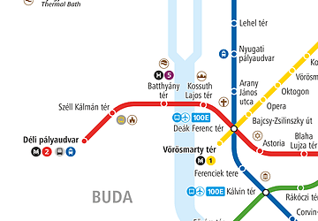 Metro
Metro
MetroDay trips


Frequently Asked Questions (FAQ)
Which popular attractions are close to Újlipótváros?
Nearby attractions include Reformed Church at the Pozsonyi road, Budapest (7 min walk), Church of Saint Margaret of Hungary, Budapest (8 min walk), Lehel Csarnok, Budapest (9 min walk), Ram Colosseum, Budapest (10 min walk).
How to get to Újlipótváros by public transport?
The nearest stations to Újlipótváros:
Bus
Metro
Tram
Train
Light rail
Trolleybus
Bus
- Victor Hugo utca • Lines: 115, 15 (2 min walk)
- Gogol utca • Lines: 115, 15 (6 min walk)
Metro
- Lehel tér • Lines: M3 (8 min walk)
- Dózsa György út • Lines: M3 (17 min walk)
Tram
- Lehel tér M • Lines: 14 (9 min walk)
- Jászai Mari tér • Lines: 2, 2M, 4, 6 (12 min walk)
Train
- Budapest-Nyugati (14 min walk)
Light rail
- Margit híd, budai hídfő • Lines: H5 (19 min walk)
- Szépvölgyi út • Lines: H5 (24 min walk)
Trolleybus
- Báthory utca / Bajcsy-Zsilinszky út • Lines: 70, 78 (20 min walk)
- Kossuth Lajos tér M • Lines: 70, 78 (23 min walk)