Manupeu Tanah Daru National Park

Facts and practical information
East Nusa Tenggara
Best Ways to Experience the Park
Wildlife
AnimalsSee what popular animal species you can meet in this location.
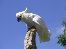
Yellow-crested cockatoo
The yellow-crested cockatoo, also known as the lesser sulphur-crested cockatoo, is a striking medium-sized bird. It is easily recognizable by its white feathers, bluish-white skin around the eyes, grey feet, black bill, and a bright yellow or orange crest that it can...
Birds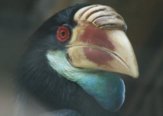
Sumba hornbill
The Sumba hornbill is a visually captivating bird from the hornbill family, named in honor of Alfred Hart Everett. This medium-sized species features predominantly black plumage, a yellowish bill accented with a maroon patch, a serrated casque atop its head, and an...
Birds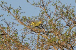
Sumba green pigeon
The Sumba green pigeon, a captivating member of the Columbidae family that encompasses pigeons and doves, is endemic to Sumba Island in Indonesia. This distinctive species thrives in the island’s verdant, subtropical, or tropical moist lowland forests.
Birds