Rawa Aopa Watumohai National Park
Facts and practical information
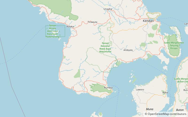
Rawa Aopa Watumohai National Park is a national park on the Indonesian island of Sulawesi, in the province of South East Sulawesi. It was declared in 1989, and has an area of 1,050 km². The park ranges from sea level to the altitude of 981 m. It contains the Aopa peat swamp, the largest in Sulawesi, and is recognised as a wetland of international importance. ()
Southeast Sulawesi
Best Ways to Experience the Park
Wildlife
AnimalsSee what popular animal species you can meet in this location.
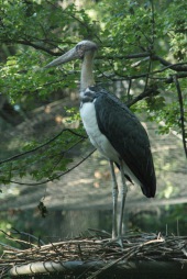
Lesser adjutant
The lesser adjutant is a captivating large wading bird belonging to the stork family, Ciconiidae. With its distinctive bare neck and head, this bird is easily recognizable in its preferred wetland habitats. Unlike its close relative, the greater adjutant, the lesser...
Birds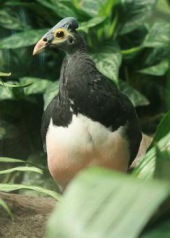
Maleo
The maleo is a fascinating bird native to the islands of Sulawesi and Buton in Indonesia. It belongs to the unique genus Macrocephalon and is typically found in lowland forests, although it nests in open, sandy areas heated by the sun or geothermal activity.
Birds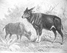
Mountain Anoa
The anoa, also known as the dwarf buffalo or sapiutan, are a distinctive subgenus of Bubalus endemic to the island of Sulawesi in Indonesia. There are two species of anoa: the mountain anoa and the lowland anoa. These small buffaloes inhabit undisturbed rainforests...
Mammals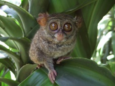
Spectral tarsier
The spectral tarsier is a captivating primate species found exclusively on the island of Selayar in Indonesia. Unlike other tarsiers, this species lacks adhesive toes, making it less specialized. Tarsiers, including the spectral tarsier, belong to the suborder...
Mammals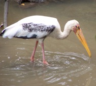
Milky stork
The milky stork is a medium-sized bird indigenous to the coastal mangroves of Southeast Asia. Once classified with the Ibis family, it is now recognized as part of the Mycteria genus, which includes other stork species with similar characteristics.
Birds